
Discover the beauty of
Palawan
Explore breathtaking destinations, hidden paradises, and unforgettable experiences.
Explore Amazing
Destinations
Discover the most beautiful places in Palawan. Find your next adventure.
All Destinations
Explore top destinations and find the perfect tour for your Palawan adventure.
Island
Pabellon Island
Taytay, Palawan
Starfish Sandbar (Luli Sandbar)
San Vicente, Palawan
Debangan Island
Taytay, Palawan
Dinot Island
Taytay, Palawan
Maxima Island
San Vicente, Palawan
Exotic Island
San Vicente, Palawan
Twin Reef
San Vicente, Palawan
Paradise Beach (Paradise Island)
San Vicente, Palawan

Malampaya
Taytay, Palawan
Shimizu Island
El Nido, Palawan
Secret Lagoon
El Nido, Palawan
South Miniloc
El Nido, Palawan
Seven Commando Beach
El Nido, Palawan
Papaya Beach
El Nido, Palawan
Snake Island
El Nido, Palawan
Entalula Island
El Nido, Palawan
Cathedral Cave
El Nido, Palawan
Cudugnon Cave
El Nido, Palawan
Hidden Beach
El Nido, Palawan
Matinloc Shrine
El Nido, Palawan
Secret Beach
El Nido, Palawan
Talisay Beach
El Nido, Palawan
Helicopter Island
El Nido, Palawan
Cadlao Lagoon
El Nido, Palawan
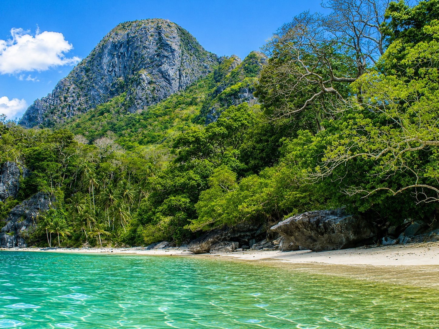
Nat-Nat Beach
El Nido, Palawan
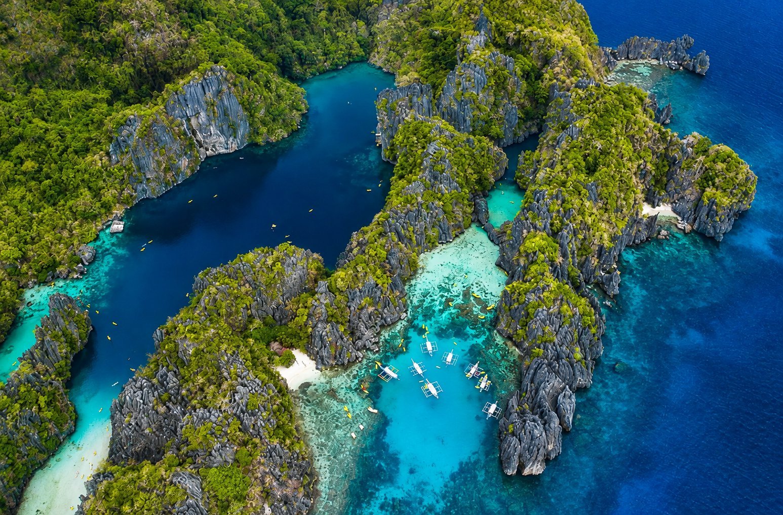
Small Lagoon
El Nido, Palawan
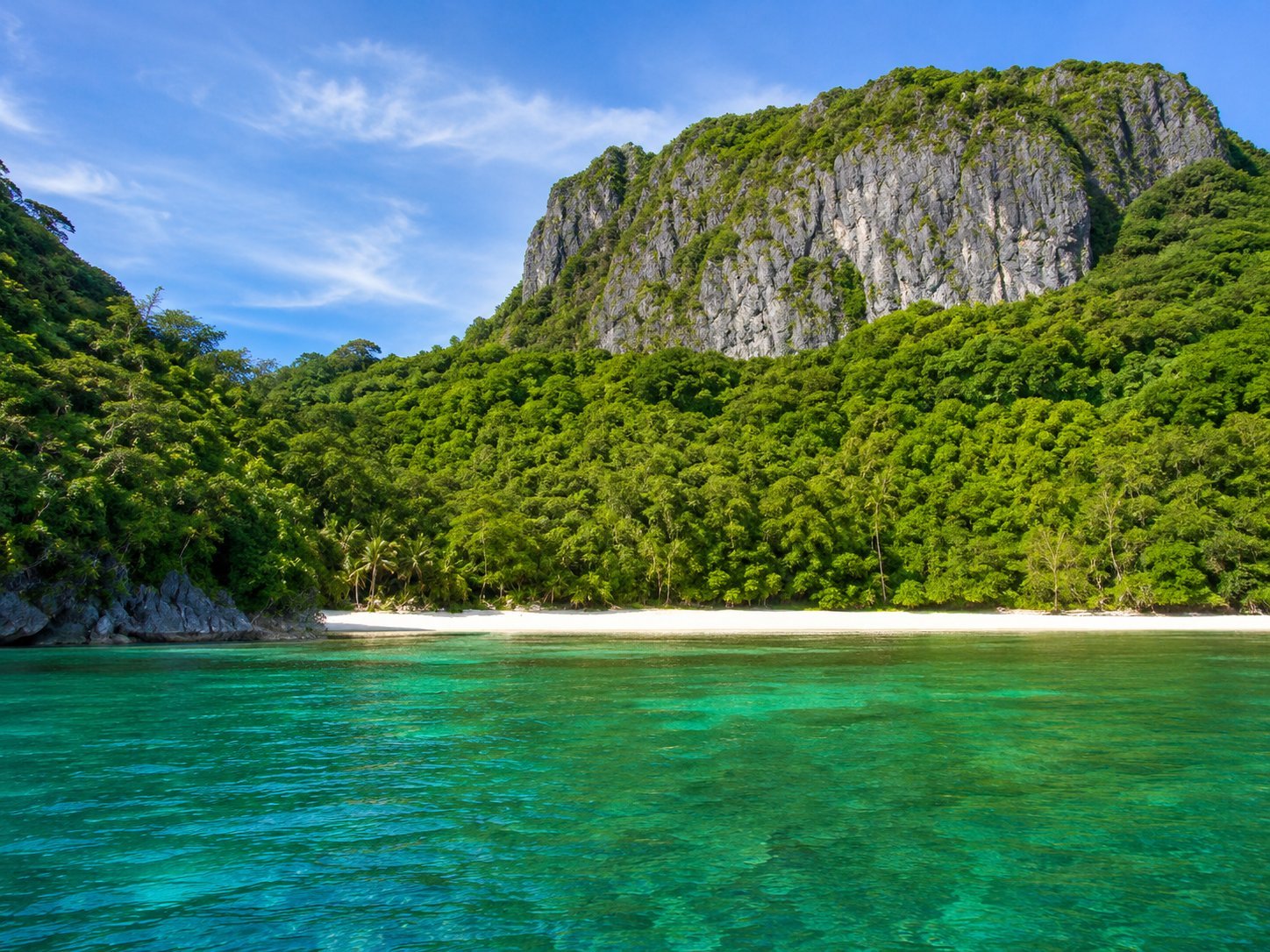
Paradise Beach
El Nido, Palawan
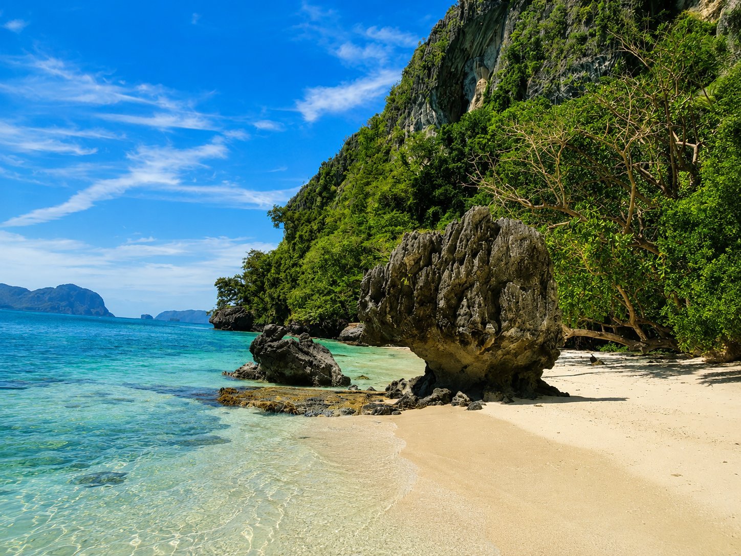
Pasandigan Cove
El Nido, Palawan
Marine Park & Protected Area
Beach
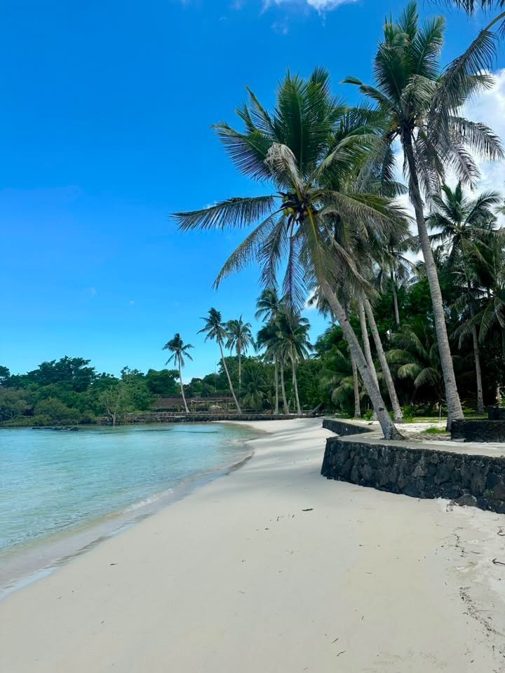
Paraiso Roberto
Taytay, Palawan
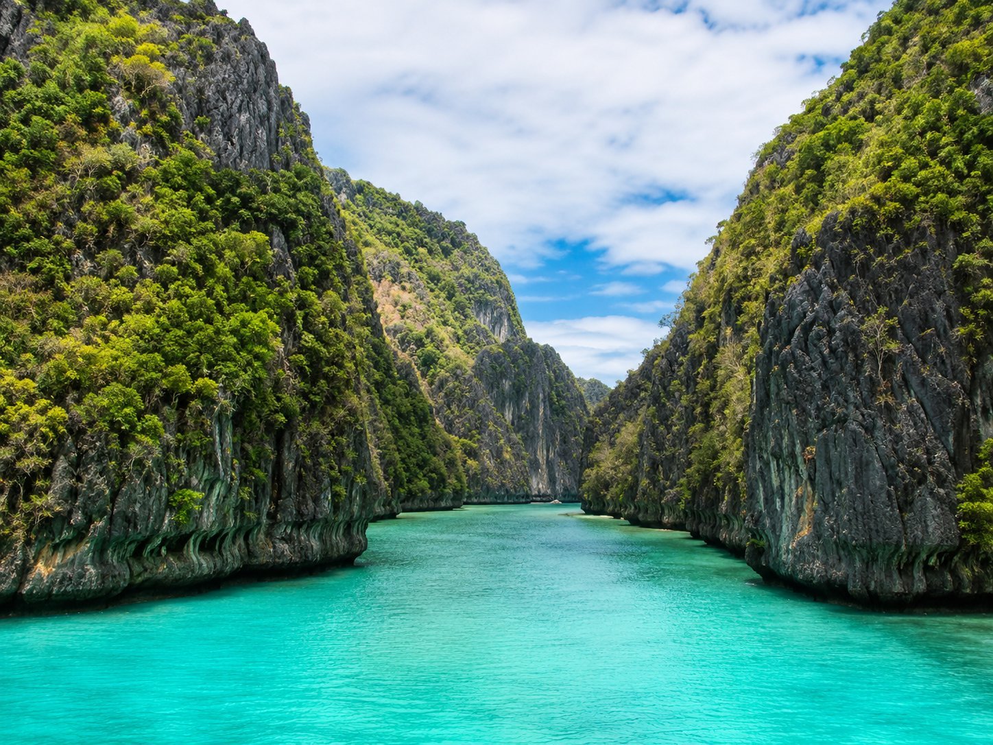
Big Lagoon
El Nido, Palawan
South Miniloc
El Nido, Palawan
Seven Commando Beach
El Nido, Palawan
Papaya Beach
El Nido, Palawan
Snake Island
El Nido, Palawan
Entalula Island
El Nido, Palawan
Hidden Beach
El Nido, Palawan
Matinloc Shrine
El Nido, Palawan
Secret Beach
El Nido, Palawan
Talisay Beach
El Nido, Palawan
Helicopter Island
El Nido, Palawan
Nat-Nat Beach
El Nido, Palawan
Paradise Beach
El Nido, Palawan
Pasandigan Cove
El Nido, Palawan
Reef & Marine Sanctuary
Cave & Underground
Lagoon
Other
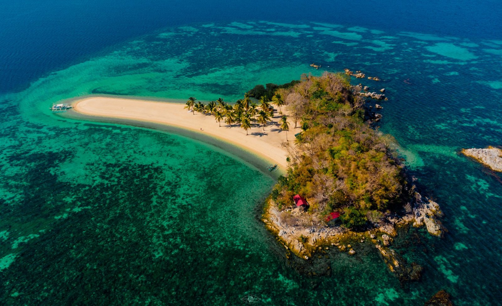
Isla Blanca/Imbaludan
Taytay, Palawan
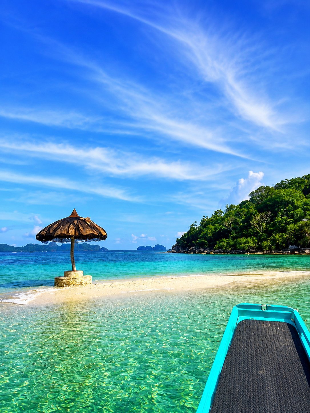
Lopez Reef
Taytay, Palawan
Fort Sta. Isabel (Kuta)
Taytay, Palawan
Honda Bay Island
City of Puerto Princesa, Palawan

Kayangan Lake
Coron, Palawan

CYC Beach
Coron, Palawan

Atwayan Beach
Coron, Palawan

Las Islas De Coral
Coron, Palawan

Quinn Reef
Coron, Palawan

Green Lagoon
Coron, Palawan

Barracuda Lake
Coron, Palawan

Smith Beach
Coron, Palawan

Skeleton Wreck
Coron, Palawan

Twin Lagoon
Coron, Palawan

Reef Garden
Coron, Palawan

Siete Pecados
Coron, Palawan

Malwawey Beach
Coron, Palawan
Coral Garden
Coron, Palawan

Malcapuya Island
Coron, Palawan

Ditaytayan
Coron, Palawan
Coco Beach
Coron, Palawan
Banana Island
Coron, Palawan

Bulog Dos
Coron, Palawan

Pass Island
Coron, Palawan

Lusong Gunboat
Coron, Palawan

Maquinit Hot Spring
Coron, Palawan

Mt. Tapyas View Deck
Coron, Palawan

Lualhati Park
Coron, Palawan

ST. AUGUSTINE CHURCH
Coron, Palawan

CORON SOUVENIR SHOP
Coron, Palawan

CASHEW HARVEST
Coron, Palawan

Calauit Safari Sanctuary
Coron, Palawan

Black Island
Coron, Palawan

Lusong Coral Garden
Coron, Palawan

Dugong Sanctuary
Coron, Palawan

Turtle Island
Coron, Palawan
TAYTAY, PALAWANPabellon Island
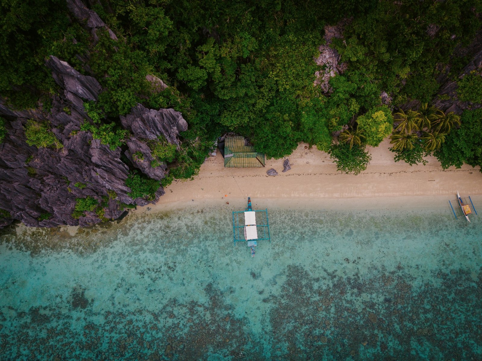
Overview Pabellon Island is one of Taytay's most remarkable island destinations, known for its dramatic limestone cliffs, secluded white-sand beaches, crystal-clear waters, and a hidden seawater lagoon concealed within a natural limestone cave. Located in the municipal waters of Taytay, the island offers visitors an opportunity to experience Palawan's rugged coastal landscapes in a relatively undeveloped setting. Beyond its natural scenery, Pabellon Island is also recognized for its balinsasayaw (swiftlet) populations. The island's limestone caves have long served as nesting sites for edible-nest swiftlets, making bird's nest harvesting an important traditional livelihood managed under local regulations. Whether you're exploring hidden coves, snorkeling in clear tropical waters, or admiring the towering limestone formations, Pabellon Island showcases the natural beauty that has made northern Palawan a sought-after destination for island-hopping adventures. What to Expect Hidden Seawater Lagoon One of Pabellon Island's most distinctive features is its hidden lagoon, located inside a natural limestone cave. Accessible from the sea, the enclosed lagoon offers a unique swimming experience surrounded by towering rock walls and naturally filtered light. Limestone Cliffs The island is surrounded by steep limestone formations that rise directly from the sea. These cliffs create dramatic coastal scenery and provide habitat for native wildlife, including swiftlets. White-Sand Beaches Several small beaches fringe the island, offering quiet places to rest, swim, or enjoy the surrounding views. Their relatively secluded setting makes them popular stops during island-hopping tours. Marine Environment The clear waters surrounding Pabellon Island support coral communities and tropical marine life. Water visibility varies depending on weather and sea conditions, making the area suitable for snorkeling during favorable conditions. Swiftlet Nesting Caves The island's limestone caves are home to balinsasayaw (edible-nest swiftlets), whose nests have been traditionally harvested for generations. Nest collection is regulated to help balance conservation with sustainable local livelihoods.
SAN VICENTE, PALAWANStarfish Sandbar (Luli Sandbar)
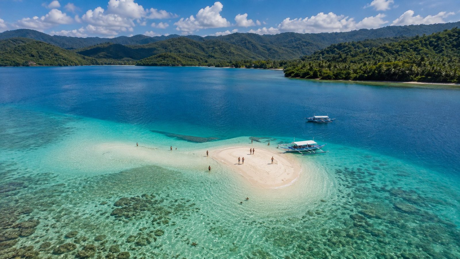
Overview Starfish Sandbar, locally known as Luli Sandbar, is a shallow sandbar located off the coast of Barangay Port Barton in the Municipality of San Vicente, Palawan. The name "Luli" is derived from the Filipino words lulubog (to sink) and lilitaw (to emerge), referring to the sandbar's changing appearance as the tide rises and falls. During low tide, portions of the sandbar become exposed, while at high tide they are largely submerged. The sandbar is well known for its clear, shallow waters where chocolate chip sea stars (Protoreaster nodosus) are commonly found on the sandy seabed. Because of the abundance of these sea stars, many visitors and local tour operators also refer to the site as Starfish Sandbar or Starfish Island. Luli Sandbar is one of the regular stops on Port Barton island-hopping tours and is valued for its calm coastal environment and natural marine setting. What to Expect Tidal Sandbar The appearance of the sandbar changes throughout the day depending on the tide. Larger areas of white sand are visible during low tide, while high tide covers much of the exposed sand. Shallow, Clear Waters The surrounding waters are generally shallow and clear, making it easy to observe the sandy seabed and marine life during favorable weather and sea conditions. Sea Stars Chocolate chip sea stars are frequently observed in the area. Visitors are encouraged to observe them in their natural habitat without lifting them from the water, as handling can cause stress and harm to the animals. Nearby Coral Areas Coral formations can be found near the sandbar, supporting reef fish and other marine organisms. Visibility varies depending on weather, tides, and sea conditions. Best Time to Visit Luli Sandbar can be visited throughout the year, although its appearance depends on the tide. Low tide provides the best opportunity to see the exposed sandbar and observe sea stars in shallow water. November to May generally offers calmer sea conditions and clearer water for island-hopping activities. June to October is typically wetter, and rough seas or heavy rainfall may affect boat operations and water visibility.
TAYTAY, PALAWANIsla Blanca/Imbaludan
Located in the Maytegued area of Taytay. Imbaludan Island is approximately an hour by boat from Taytay's mainland, depending on sea conditions. Its relatively secluded location makes it an ideal destination for travelers looking for a quiet and authentic Palawan island experience. A hidden tropical paradise where powdery white sands meet crystal-clear turquoise waters. Surrounded by vibrant coral gardens and tranquil seas, Isla Blanca is perfect for snorkeling, swimming, diving, island hopping, and simply enjoying the untouched beauty of Palawan. A serene escape where you can experience the beauty of an island paradise without the crowds. What to expect Expect a quiet, uncrowded tropical escape with powdery white sand, turquoise water, and a beautiful coral garden. Activities 🤿 Snorkeling 🏊 Swimming 🏖️ Sandbar & Beach Walks 📸 Photography 🍱 Picnic & Relaxation 🤿 Beginner Diving Best Time to Visit 🌞 November–May: Best overall period 🌊 High tide: Better for swimming and snorkeling 🏖️ Low tide: Best for enjoying the white sandbar 🌅 Morning: Usually ideal for island hopping, photography, and snorkeling before weather conditions change
TAYTAY, PALAWANLopez Reef
Lopez Reef is one of Taytay Bay's notable marine destinations, known for its beautiful coral gardens, abundant reef fish, and clear tropical waters. It is recognized as a reef and dive site in Taytay's tourism resources, with snorkeling, diving, and marine research among its potential uses. A reef survey around the area recorded 71.25% hard-coral cover at Lopez Reef, considered good in that study, along with a diverse community of reef fish. 🤿 What to Expect 🪸 Beautiful coral gardens — The underwater scenery is the main attraction. 🐠 Colorful marine life — Expect tropical reef fish, including wrasses, parrotfish, groupers and other species recorded in Taytay Bay. 💎 Clear water — Visibility can be excellent when weather and sea conditions cooperate. 🏖️ Small white-sand area/sandbar — Lopez Reef is also associated with a white sandbar, although its size and appearance depend on tides. 🌊 Possible currents — Conditions can vary. A visitor account specifically recommends wearing fins because currents may make swimming back to the boat more difficult. 🏊 Activities 1. Snorkeling 🤿 This is probably the best activity for most visitors. Swim above the coral gardens and observe reef fish and other marine life. 2. Scuba Diving 🐠 Lopez Reef is recognized as a Taytay dive site, and its reef formations include drop-offs and walls that are attractive to divers. 3. Underwater Photography 📸 The coral formations and colorful fish make Lopez Reef particularly appealing for underwater photography. 4. Sandbar Visit 🏝️ Depending on the tide, you can enjoy the small white-sand area and take photos. 5. Island Hopping 🚤 Lopez Reef works particularly well as a snorkeling stop combined with Isla Blanca and Pabellon Island. This combination is also reflected in Taytay island-hopping itineraries. ☀️ Best Time to Visit For Taytay island hopping, November to May is generally the better period because conditions are typically more favorable for boat travel and water activities. Best experience: 🌤️ March–May: Excellent period to aim for sunny days and good underwater visibility. 🌊 Morning: Recommended for snorkeling and diving when sea conditions are favorable. 🏖️ Low tide: Better if you specifically want to see/enjoy the sandbar. 🌧️ June–October: Rainier months; trips can be more dependent on actual weather and sea conditions. Important: Lopez Reef is primarily an underwater destination, so don't judge the experience only from the surface. Its real attraction is beneath the water—the coral gardens and marine life.
TAYTAY, PALAWANDebangan Island
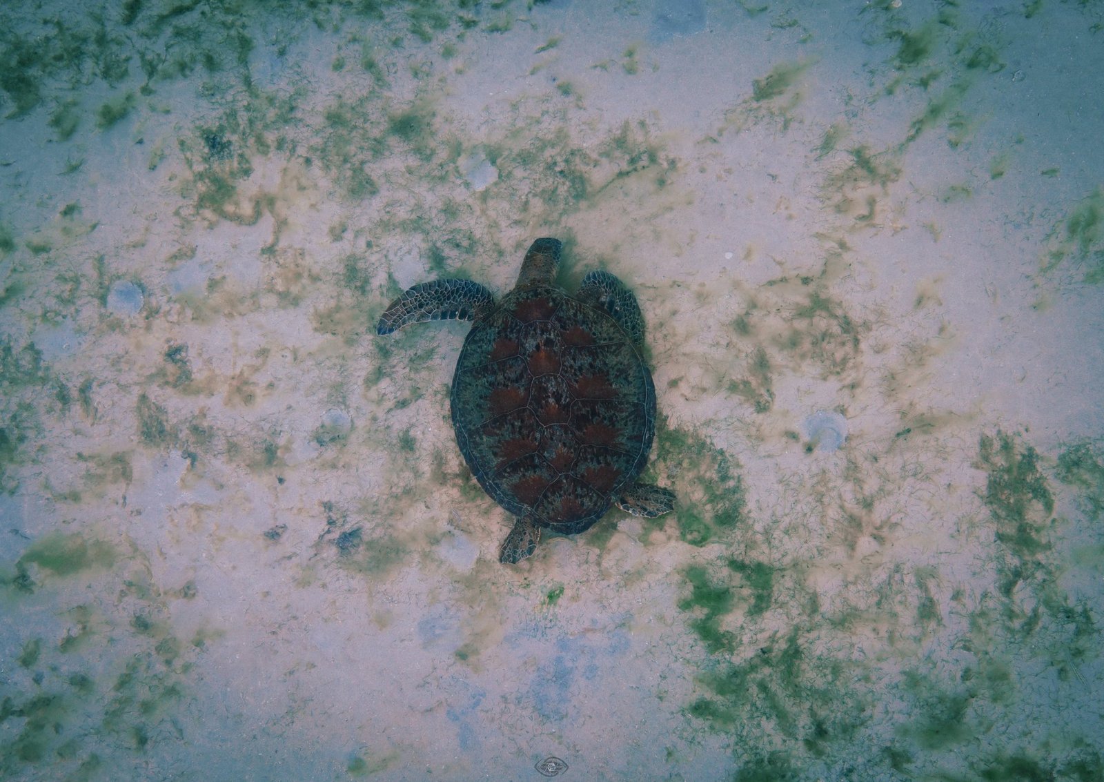
Debangan Island — Taytay, Palawan Journey beyond the usual island-hopping route and discover the peaceful beauty of Debangan Island. Famous for its long stretches of white sand and gentle green sea turtles feeding among the seagrass, Debangan offers a rare opportunity to connect with Palawan's marine life in a natural setting. Swim, kayak, snorkel, explore the coastline, or spend the night under the stars with a seaside bonfire and fresh local seafood. Debangan is not just an island destination—it is an unforgettable sea-turtle encounter in the wild. 🌊 What to Expect 🏖️ Long white-sand beaches — Debangan's coastline includes beaches extending for about 1.6 km. 🐢 Green sea turtles — The island's biggest attraction is the opportunity to observe sea turtles feeding around the seagrass beds. 🌿 Seagrass-rich coastal waters — These provide an important feeding habitat for the turtles. 🌴 A remote island atmosphere — Because of the long boat journey, Debangan feels more secluded and less developed than the better-known island destinations. 🚤 A scenic boat adventure — The trip from Taytay takes several hours, so it is best planned as a dedicated day trip or overnight experience. 🐢 Activities 1. Sea Turtle Watching & Swimming This is the signature Debangan experience. Visitors can observe green sea turtles around the island's seagrass areas and, where conditions and local guidelines allow, swim near them. Important: Keep a respectful distance, never chase or touch the turtles, and avoid stepping on seagrass or coral. 2. Swimming 🏊 Enjoy the clear coastal waters and white-sand beaches when sea conditions are calm. 3. Kayaking 🚣 Traditional baruto, a local wooden kayak boat, is among the activities associated with Debangan. 4. Snorkeling 🤿 Explore the shallow coastal waters and marine environment. Ask your local boatman or guide about the safest and most interesting snorkeling areas on the day of your visit. 5. Scuba Diving 🤿 Diving is also listed among activities available around Debangan for visitors looking for a deeper exploration of the surrounding marine environment. 6. Overnight Camping ⛺ For a more immersive experience, Debangan can be visited overnight. Local tourism information describes camping, bonfires and fresh seafood as part of the island experience. ☀️ Best Time to Visit For a comfortable island-hopping and sea-turtle experience, November to May is generally the better period to visit Taytay. Recommended: ☀️ March–May: Great choice for sunny days and beach activities. 🌤️ November–February: Generally favorable, but sea conditions can vary. 🌧️ June–October: Wetter period; the long boat trip can be more affected by rain and rough seas. 🚤 Start early: Because the journey can take 3–4 hours each way, an early departure is especially important for a day trip.
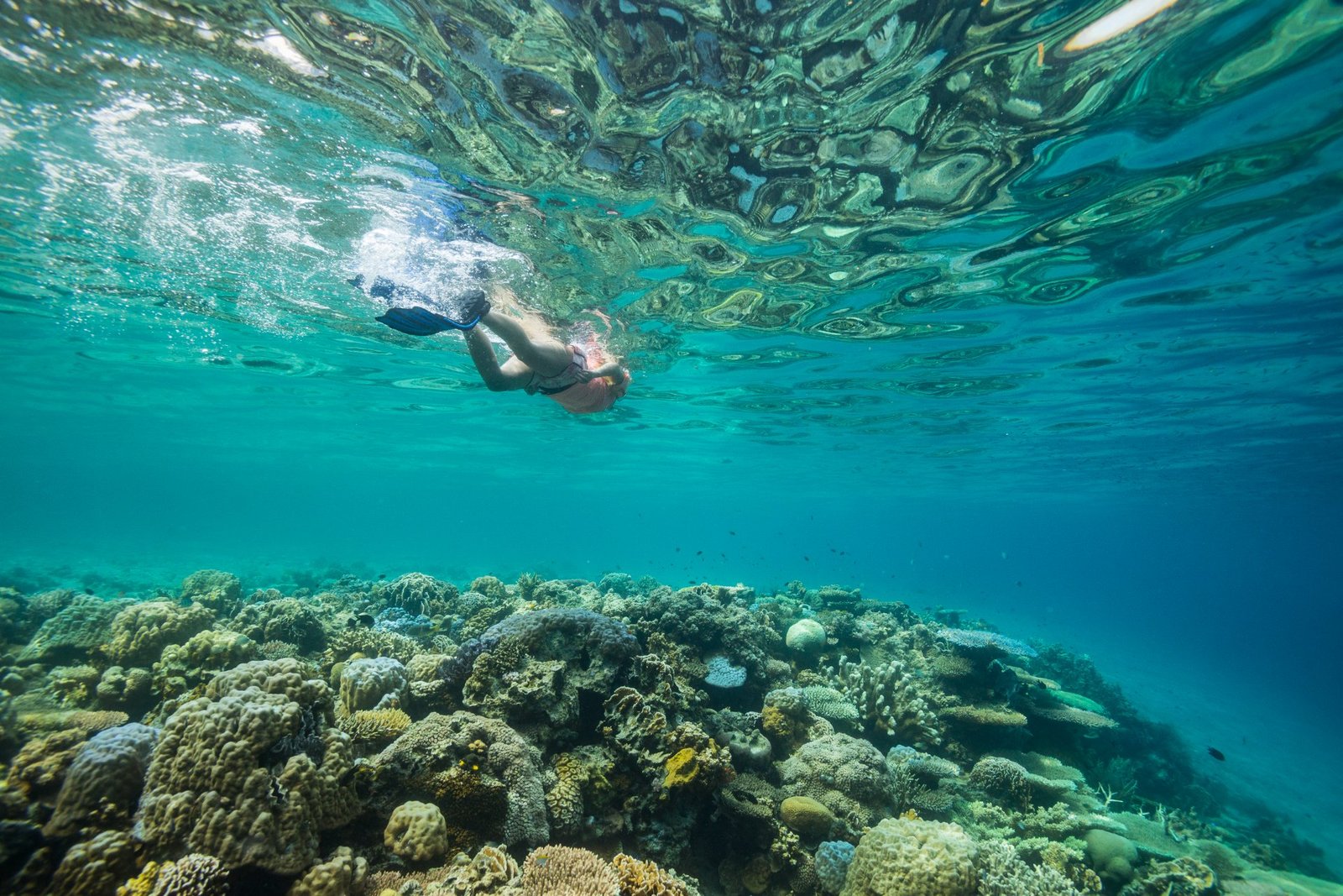
TAYTAY, PALAWANDinot Island
Dinot Island is a lesser-known island destination in Taytay, Palawan, offering a more peaceful and natural island experience away from the busier tourist routes.Away from the crowds, the island invites travelers to slow down, explore the surrounding marine environment, swim in crystal-clear waters, and enjoy the simple beauty of nature. Whether you're snorkeling, island hopping, taking photographs, or simply relaxing by the sea, Dinit offers an authentic and peaceful Palawan experience 🌊 What to Expect 🌴 Quiet and less-developed surroundings — ideal for travelers looking for a more authentic island experience. 💎 Clear tropical waters — visibility depends on weather, tides and sea conditions. 🪸 Marine environment — the waters around Taytay are known for coral reefs and diverse marine life. 🚤 Island-hopping adventure — Dinit is best experienced as part of a boat excursion around Taytay's islands. 📸 Natural scenery — excellent for landscape, seascape and boat photography. 🌿 Limited facilities — visitors should come prepared with drinking water, food, sun protection and other essentials. ☀️ Best Time to Visit For marine activities and island hopping in Taytay, November to May is generally the preferred period. Taytay's drier season offers more favorable conditions for outdoor activities, although weather and sea conditions can still change. ☀️ March–May: Excellent months to aim for sunny island-hopping days. 🌤️ November–February: Generally favorable, but check wind and sea conditions. 🌧️ June–October: Wetter season; boat trips may be more affected by rain and rough seas. 🚤 Morning: A good time to start an island-hopping trip, subject to the day's weather, tide and sea conditions.
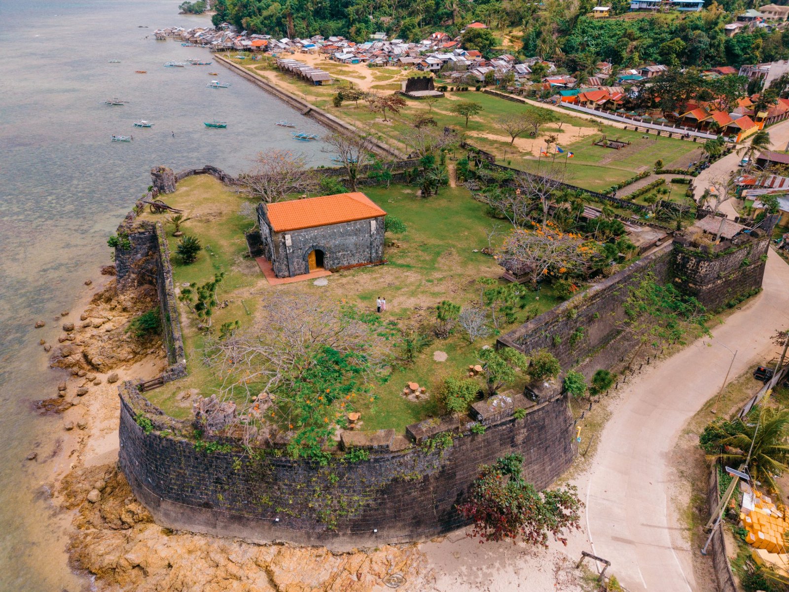
TAYTAY, PALAWANFort Sta. Isabel (Kuta)
Fort Santa Isabel, also known as Fuerza Santa Isabel de la Paragua or Taytay Fort, is one of Taytay's most important historical landmarks. Originally established as a wooden palisade in 1667, it was later rebuilt in coral limestone and completed in 1738. The fort served as a Spanish-era defensive stronghold overlooking Taytay Bay. Step into the pages of Palawan's history at Fort Santa Isabel, a centuries-old Spanish-era fortress overlooking the beautiful waters of Taytay Bay. Built from enduring coral limestone, the fort stands as a reminder of Taytay's rich heritage and storied past. Explore its historic walls, cannons, chapel and peaceful gardens while taking in panoramic views of the bay. Whether you're a history enthusiast, a photography lover, or simply looking for a meaningful cultural experience, Fort Santa Isabel offers a unique glimpse into the history and soul of Taytay, Palawan. Today, it offers visitors a combination of history, architecture, culture, and panoramic views of Taytay Bay. The fort was also restored in 2018–2019 as part of a heritage-development project. 👀 What to Expect 🧱 Historic coral-limestone walls and Spanish-era architecture ⚔️ Old cannons and defensive structures ⛪ A small historic chapel within the fort 🌊 Beautiful views of Taytay Bay 🌿 A maintained garden and peaceful surroundings 🏛️ A small museum/exhibit area showcasing the site's history 📸 Plenty of opportunities for historical and scenic photography 🌅 Beautiful views toward the bay, especially later in the afternoon ☀️ Best Time to Visit Taytay's drier season from November to May is generally the most comfortable period for sightseeing and outdoor activities. Recommended times: 🌤️ November–February: Pleasant for walking around the fort. ☀️ March–May: Good for sunny skies and photography. 🌅 3:00–5:30 PM: Ideal for avoiding the strongest midday heat and enjoying softer afternoon light. 🌧️ June–October: Still possible to visit, but expect a greater chance of rain.
TAYTAY, PALAWANParaiso Roberto
Escape to the peaceful beauty of Paraiso Roberto, where the beach meets the lush tropical forest in a serene coastal setting. Walk along the wide shoreline at low tide, enjoy a refreshing swim, capture beautiful photographs, or simply relax to the sound of the sea. Away from the crowds, Paraiso Roberto offers a laid-back Palawan experience where nature, tranquility, and the simple beauty of the beach come together. 🌊 What to Expect: 🏖️ A spacious beach area, especially noticeable during low tide. 🌴 Natural, tropical surroundings with greenery close to the beach. 🌊 Changing shoreline — the beach is particularly interesting at low tide, when more sand is exposed. 📸 Beautiful scenery for photography, especially wide beach and coastal shots. 😌 Relaxed atmosphere — a place to slow down and enjoy the natural surroundings. 🏡 A more local and laid-back beach-resort experience rather than a large commercial resort. ☀️ Best Time to Visit For Taytay, November to May is generally the preferred period for beach activities and outdoor sightseeing, with June to October being the wetter season. Best experience: ☀️ March–May: Great for sunny beach days and photography. 🌤️ November–February: Generally favorable, with somewhat cooler conditions. 🏖️ Low tide: Best for experiencing the wide exposed beach and taking photos. 🌅 Late afternoon: Ideal for a more comfortable beach experience and softer photography light. 🌧️ June–October: Still visitable, but check the weather before planning outdoor activities.
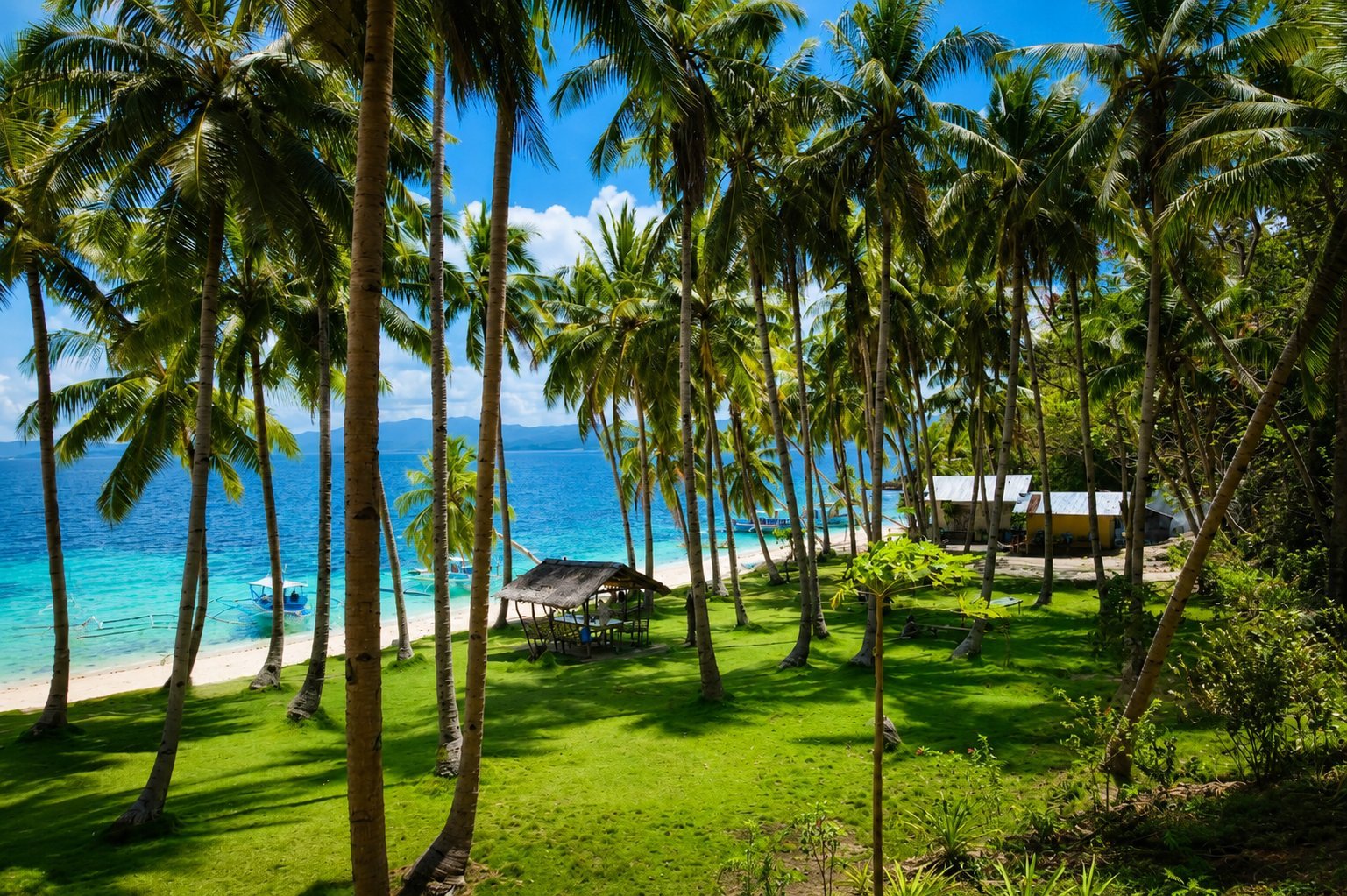
SAN VICENTE, PALAWANMaxima Island
Maxima Island is one of the most frequently visited islands during Port Barton island-hopping tours. It features a white sand beach surrounded by tropical vegetation and shallow turquoise waters. At extremely low tide, a natural sandbar may connect Maxima Island with nearby Exotic Island, allowing visitors to walk between the two islands. What to Expect Maxima Island provides a relaxing beach setting where many tours stop for lunch, swimming, or free time. The surrounding waters are generally calm and suitable for recreational swimming.
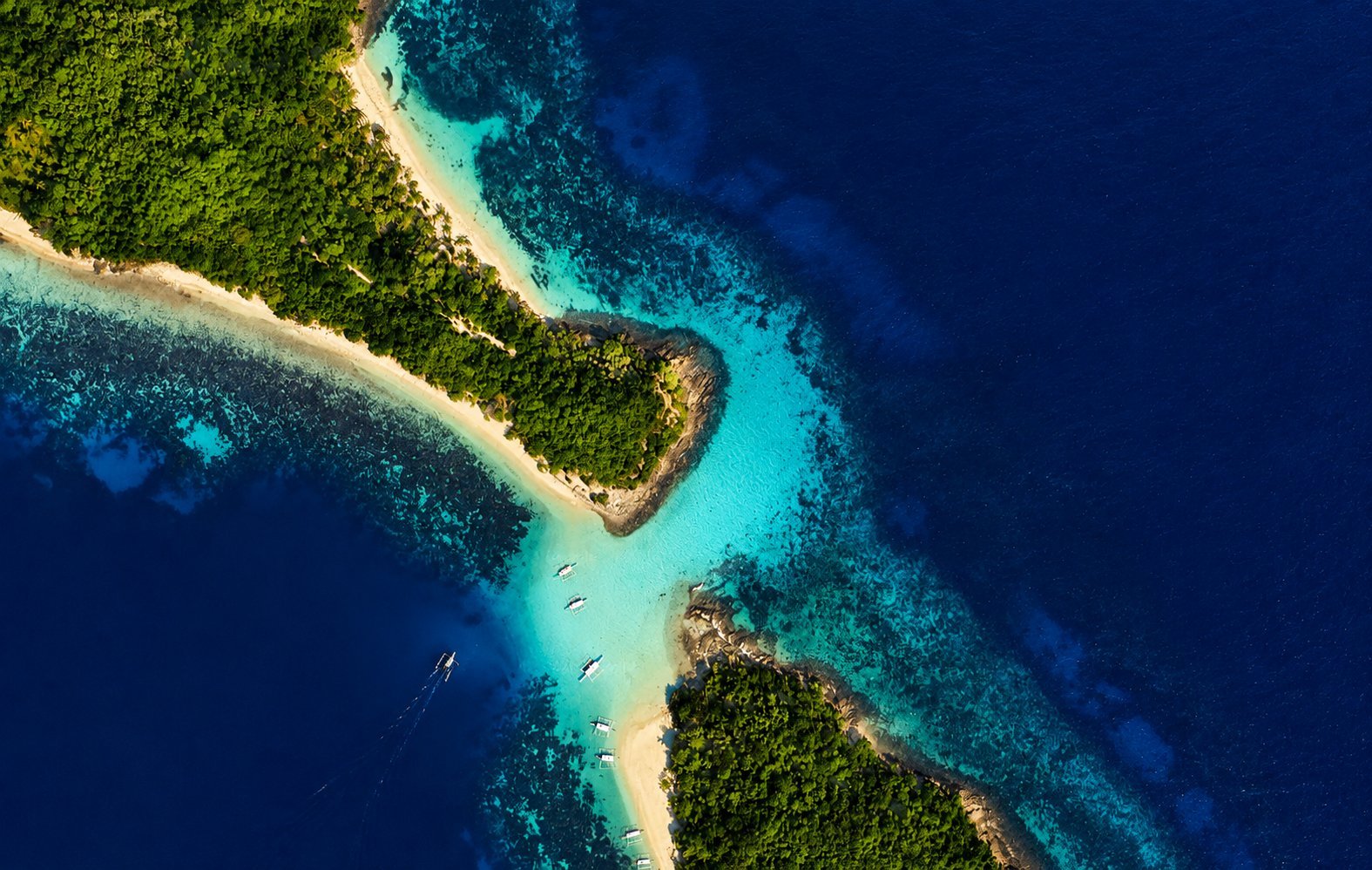
SAN VICENTE, PALAWANExotic Island
Exotic Island is a small tropical island located near Maxima Island in the Port Barton island-hopping area. It is recognized for its white sand beach and clear coastal waters. During very low tide, a sandbar may emerge between Exotic Island and Maxima Island, allowing visitors to walk across the shallow channel. What to Expect Visitors typically stop here for swimming, snorkeling near the shoreline, or relaxing on the beach. The island's tranquil setting makes it one of the quieter destinations within the Port Barton marine area.
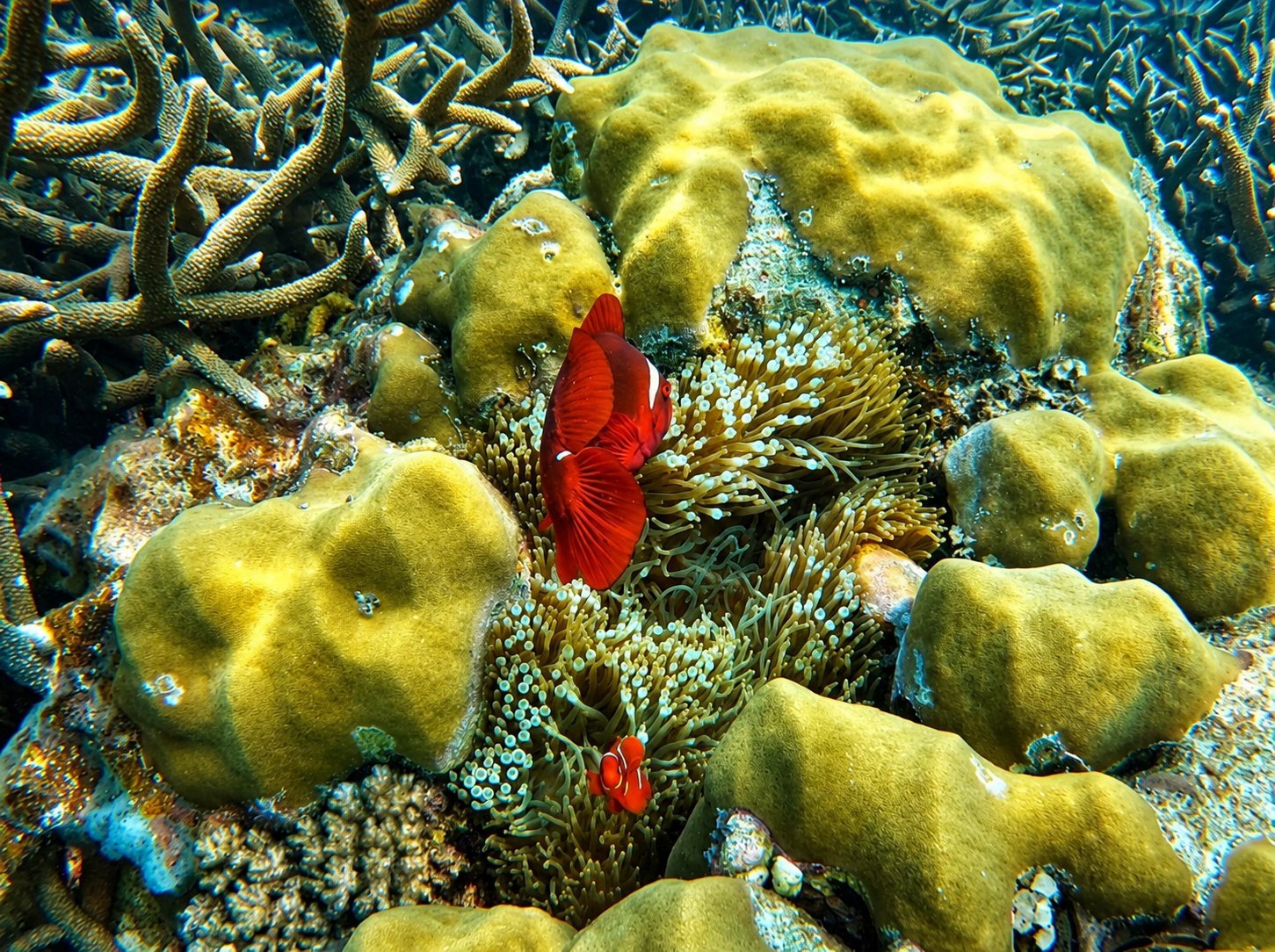
SAN VICENTE, PALAWANTwin Reef
Twin Reef is one of the principal snorkeling sites in the Port Barton Marine Park. It consists of shallow coral reef formations that support a diverse variety of tropical reef fish and marine organisms. Water visibility varies according to sea conditions, currents, and weather. What to Expect Twin Reef is visited primarily for snorkeling. Healthy coral formations and abundant reef fish make it one of the area's most popular underwater attractions. Visitors are encouraged to avoid standing on or touching coral to help protect the marine ecosystem.
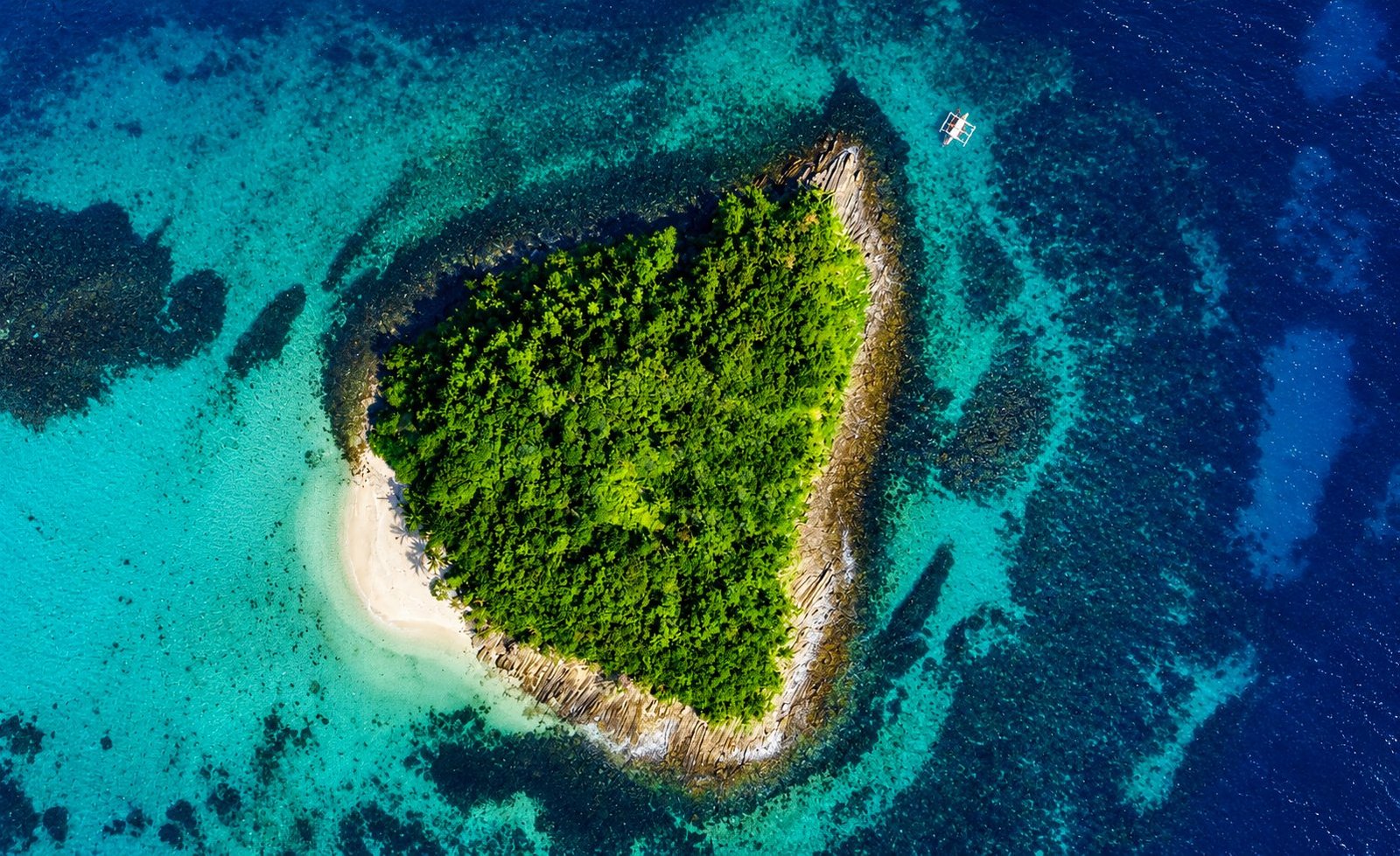
SAN VICENTE, PALAWANParadise Beach (Paradise Island)
Paradise Beach, also referred to by some operators as Paradise Island, is a secluded white sand beach accessible by boat from Port Barton. It is valued for its calm atmosphere, clear waters, and natural surroundings, making it a popular stop for swimming and beach relaxation during island-hopping tours. What to Expect Visitors will find soft white sand, shallow turquoise water, and a peaceful tropical setting. Depending on the itinerary and sea conditions, the beach may serve as a swimming stop or a place to rest before continuing to the next destination.
 TAYTAY, PALAWAN
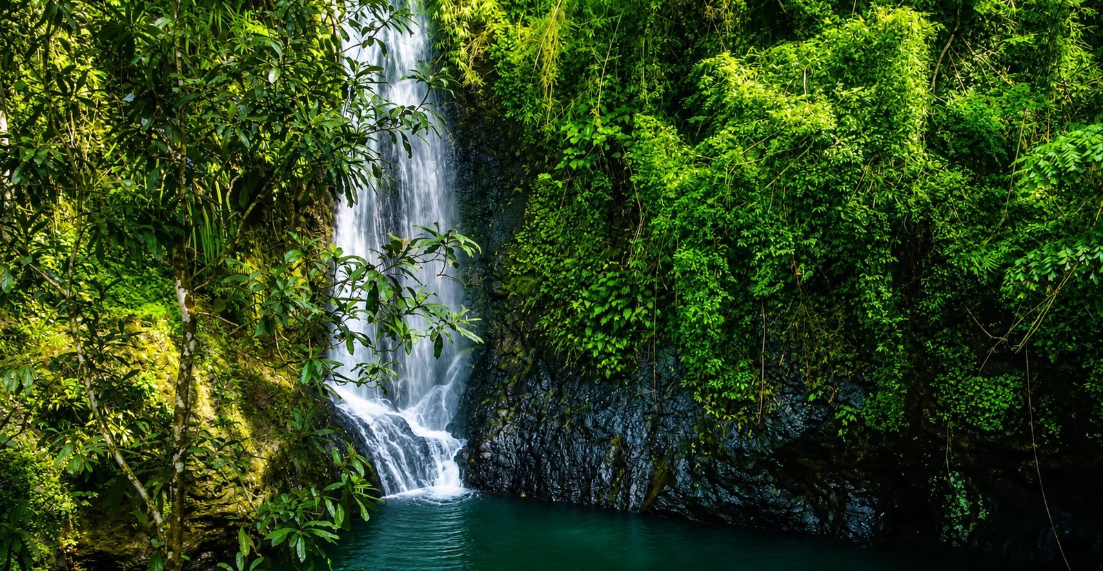
Cuyaoyao Falls
Kuyawyaw Falls, also spelled Cuyaoyao Falls, is one of Taytay's beautiful inland nature attractions. Located in Barangay Cataban, about 27 km north of Taytay town, it features three cascading waterfalls surrounded by dense tropical forest. The falls are reached by a forest trail that includes some rope-assisted sections and river crossings. Journey deep into the lush forests of Taytay and discover the refreshing beauty of Kuyawyaw Falls, a spectacular three-tiered waterfall surrounded by pristine tropical greenery. Trek through the forest, cross natural streams, swim in cool freshwater pools, and listen to the soothing sound of cascading water. For adventure seekers, the falls also offer exciting cliff-jumping opportunities, while nature lovers can enjoy bird watching, photography, and peaceful moments beneath the forest canopy. Kuyawyaw Falls is the perfect inland escape for travelers looking to experience the wild, refreshing, and authentic side of Taytay, Palawan. What to Expect 💦 Three waterfalls with natural freshwater pools. 🌴 Dense tropical forest providing shade for most of the trail. 🥾 Moderate jungle hike — expect muddy or slippery sections, especially after rain. 🪢 Rope-assisted sections on some steeper portions of the trail. 🌊 Freshwater swimming pools beneath the falls. 🐦 Nature and bird-watching opportunities along the forest trail. 🌿 A relatively natural, uncrowded atmosphere compared with more developed tourist attraction, ☀️ Best Time to Visit Interestingly, Kuyawyaw Falls is different from Taytay's island destinations: visiting shortly after rainfall can produce a much stronger waterfall flow. Recent visitor reports specifically recommend visiting after heavy rain or during the rainy season for the most impressive waterfalls. Best experience: 🌧️ After recent rainfall: Best chance of seeing the falls flowing strongly. 🌤️ Dry season: Better for a more comfortable trail, but water flow may be lower. 🌅 Morning: Recommended for cooler hiking conditions and more time to explore all three falls. ⚠️ During heavy rain: Avoid trekking if the trail or river crossings become dangerous. Always follow local guide instructions. 🎒 What to Bring Wear proper trekking or water shoes because parts of the trail can become muddy and slippery. Bring drinking water, insect repellent, sun protection, a change of clothes, and a waterproof bag for valuables.
 TAYTAY, PALAWAN
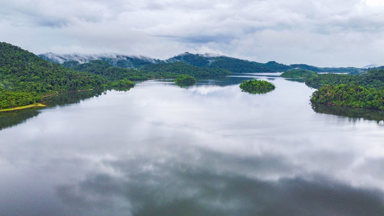
Lake Manguao
Manguao Lake, also known as Lake Danao, is a peaceful freshwater lake and municipal conservation area in Taytay, Palawan. Surrounded by lush forest, it is one of Taytay's best destinations for inland ecotourism, nature exploration, and birdwatching. The lake covers about 6.7 square kilometers, and more than 130 bird species have been reported in the surrounding ecosystem. Escape into the peaceful heart of Taytay at Lake Manguao, a pristine freshwater sanctuary embraced by lush tropical forests. Paddle across tranquil waters, discover a remarkable diversity of birdlife, explore the surrounding wilderness, or simply watch the sunrise and sunset reflected across the lake. For nature lovers, adventurers, birdwatchers, and travelers seeking a quiet escape, Lake Manguao offers a refreshing glimpse of the wild and beautiful side of Taytay, Palawan. What to Expect 🌿 Lush forest surrounding a tranquil freshwater lake 🐦 Exceptional birdwatching, with kingfishers, herons, eagles and other birds reported around the lake. 🛶 Peaceful kayaking and boating across the lake 🌅 Beautiful sunrise and sunset reflections on the water 🎣 A natural setting where fishing is also practiced ⛺ A quiet, relatively undeveloped environment—don't expect extensive commercial facilities. A visitor report noted the absence of nearby shops and facilities. ☀️ Best Time to Visit For a comfortable outdoor experience, the generally drier period of November to May is a good choice. However, Lake Manguao is an inland nature destination, so the best time also depends on what you want to experience. 🌅 Sunrise: Best for birdwatching and peaceful photography. 🐦 Late afternoon/dusk: Excellent for bird activity and sunset views. ☀️ March–May: Good choice for hiking, kayaking and camping with generally favorable weather. 🌧️ June–October: The landscape can be especially lush, but rain may make access and outdoor activities less predictable. 🛶 Calm weather: Best for kayaking and boating.
TAYTAY, PALAWANMalampaya
Malampaya Sound is one of Taytay's most remarkable natural attractions and a protected landscape and seascape. It is particularly famous for the Irrawaddy dolphin (Orcaella brevirostris), a critically endangered species found in the inner part of the Sound. Bottlenose dolphins have also been documented in the area. Beyond dolphin watching, Malampaya offers a beautiful combination of mangrove forests, beaches, seagrass beds, coral reefs, and tranquil coastal scenery, making it an excellent destination for nature and eco-adventure. What to Expect 🐬 Dolphin watching in the wild — sightings are not guaranteed, but Malampaya is an important habitat for Irrawaddy dolphins. 🌿 Mangrove-lined waterways and beautiful coastal scenery. 🏖️ Quiet beaches where visitors can relax and enjoy the natural surroundings. 🚤 Scenic boat journey through the Sound. 🐦 Rich wildlife and marine ecosystem, including birds, fish, mangroves, seagrass and coral habitats. 🌅 Peaceful sunrise and sunset experience — dolphin-watching trips can begin very early because dolphins are active while feeding in the morning. Best Time to Visit November to May is generally a good period for outdoor activities in Taytay, but dolphin watching is especially dependent on actual weather, sea conditions and dolphin behavior. For dolphin watching, early morning—around sunrise—is the preferred time, as dolphins are known to forage during the morning. Interestingly, Taytay's coastal-resource survey recorded the highest number of cetacean sightings during May and June in its surveyed data, although sightings can occur throughout the year. Recommended: 🐬 Early morning: Best time to search for dolphins. ☀️ March–May: Generally favorable weather for boat and beach activities, Sunset watching. 🐋 May–June: Worth considering if dolphin sightings are your main priority, based on documented local survey observations. 🌧️ June–October: More weather-dependent; check sea conditions before departure. Responsible Dolphin Watching Because the Irrawaddy dolphin is critically endangered, the experience should focus on observing rather than pursuing the animals. Maintain a respectful distance, avoid sudden boat approaches, never feed or touch dolphins, and follow the instructions of local boat operators and wildlife guides
 CITY OF PUERTO PRINCESA, PALAWAN
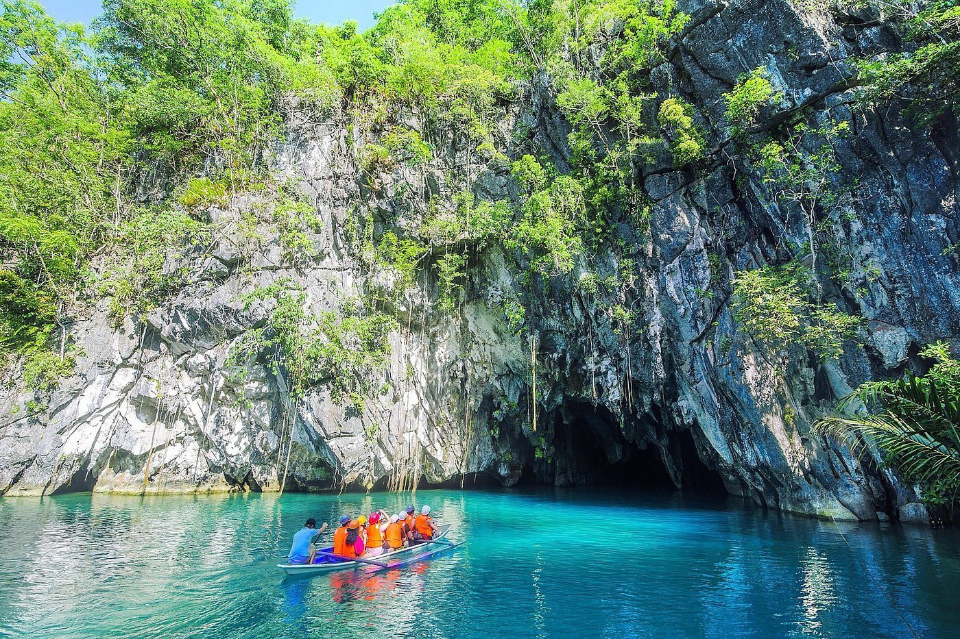
Puerto Princesa Subterranean River National Park (Underground River)
Puerto Princesa Subterranean River National Park (Underground River) Location: Barangay Cabayugan, Puerto Princesa City, Palawan, Philippines Puerto Princesa Subterranean River National Park is a protected natural area on the midwestern coast of Palawan, centered on an underground section of the Cabayugan River that passes through the limestone karst of the St. Paul Mountain Range before flowing directly into the sea. The park protects approximately 22,202 hectares and contains an 8.2-kilometer underground river system with a lower section influenced by ocean tides. Its landscape links forests, karst mountains, caves, rivers, wetlands, and coastal habitats in a mountain-to-sea ecosystem. The park was inscribed as a UNESCO World Heritage Site in 1999 for its exceptional natural features and biodiversity importance. 🌊 What to Expect Underground river and cave system – The Cabayugan River disappears beneath the limestone of Mount St. Paul and continues through an extensive cave system before reaching the sea. The underground river extends approximately 8.2 kilometers. Limestone karst formations – Inside and around the cave are limestone formations created by long-term geological processes. The wider park includes rugged karst cliffs, caves, sinkholes, forested hills, and mountain terrain. River-to-sea connection – A distinctive feature of the subterranean river is that it flows directly into the sea. Its lower section is brackish and affected by tidal conditions, an important part of the site's natural significance. Mountain-to-sea ecosystem – The protected area contains multiple connected habitats, including lowland and limestone forests, riverine areas, freshwater swamps, mangroves, beaches, seagrass beds, and coastal ecosystems. Cave and forest wildlife – Bats and swiftlets inhabit the cave, while the surrounding forests support Palawan wildlife including hornbills, the Palawan peacock-pheasant, long-tailed macaques, monitor lizards, and numerous other native species. Wildlife sightings are naturally not guaranteed. Internationally protected natural heritage – The park is recognized by UNESCO for both its exceptional natural landscape and its importance as habitat for biodiversity conservation. It is also listed as a Wetland of International Importance under the Ramsar Convention. 🧭 Good to Know Protected-area rules apply – The Underground River forms part of a nationally protected area and UNESCO World Heritage Site. Visitors should follow park regulations and instructions intended to protect the cave, wildlife, forests, and surrounding ecosystems. Visitor access is managed – Entry to the Underground River is controlled by park management rather than being unrestricted cave access. Visitor arrangements should therefore be confirmed before traveling to the site. Weather can affect access – Underground River trips involve both coastal and cave environments, and the official park information notes that tours may be suspended during extreme weather conditions. Respect wildlife – Macaques, monitor lizards, birds, bats, and other animals occur naturally within the park. Observe wildlife from an appropriate distance and avoid feeding or disturbing animals.
 CITY OF PUERTO PRINCESA, PALAWAN
Puerto Princesa Palawan City
The Puerto Princesa Palawan City Tour is a sightseeing experience that brings together several of the city’s established cultural, historical, nature, and leisure attractions. It is not a single geographic attraction and therefore does not have one specific barangay ; stops are located across different parts of Puerto Princesa City. The official City Tourism Office lists attractions such as Plaza Cuartel, Puerto Princesa Baywalk, Baker’s Hill, Butterfly Garden, Mitra Ranch, the Crocodile Farm and Nature Park, and other sites as city-tour destinations. 🌊 What to Expect Historical landmarks – Sites such as Plaza Cuartel provide context about Puerto Princesa’s history, including its World War II heritage. The National Historical Commission of the Philippines identifies Plaza Cuartel as a historical site. PPhilippine Historical Sites City waterfront – Puerto Princesa Baywalk is a public waterfront area with space for strolling, leisure, food stalls, and bicycle riding. The City Tourism Office identifies it as a city attraction in Barangay Matiyaga. Nature and wildlife attractions – The city-tour itinerary can include purpose-built attractions such as the Butterfly Garden and Crocodile Farm and Nature Park, where visitors can learn about local butterflies and crocodilian species. Scenic countryside – Mitra Ranch is one of the city’s listed sightseeing stops and provides elevated views over Puerto Princesa. Cultural and local-interest sites – Puerto Princesa’s tourism attractions also include historical, religious, museum, and community-oriented sites, allowing a city tour to cover more than natural scenery alone. 📍 Location A Puerto Princesa city tour covers attractions distributed across the urban area and surrounding barangays rather than one defined destination. For example, the City Tourism Office places Puerto Princesa Baywalk in Barangay Matiyaga , while its tourism listings identify community-based destinations and other attractions in barangays such as Iwahig, Buenavista, and Tagabinet. 🧭 Good to Know A city tour should not be treated as synonymous with the Puerto Princesa Underground River tour . The Underground River is a separate protected-area attraction in Barangay Cabayugan and forms part of the Puerto-Princesa Subterranean River National Park. City-tour stops can vary by commercial itinerary, so not every attraction listed by the City Tourism Office will necessarily be included in every package. Some attractions are located outside the immediate city center, so the geographic coverage of a city tour can extend into surrounding barangays. Visitors should follow the individual environmental, conservation, and visitor rules applicable to each attraction.
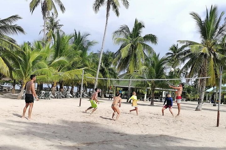
CITY OF PUERTO PRINCESA, PALAWANHonda Bay Island
Honda Bay Island Location: Sta. Lourdes / Honda Bay area, Puerto Princesa City, Palawan, Philippines Honda Bay Island Hopping Tour is a marine sightseeing and island-hopping experience along the mid-eastern coast of Puerto Princesa City. The usual departure point is the Honda Bay Wharf in Barangay Sta. Lourdes , where community-based boat operators serve visitors traveling to islands and marine sites within the bay. Puerto Princesa’s City Tourism Office identifies Honda Bay as an island-hopping destination with several islands, coral-and-sand areas, and sites used for marine recreation. Depending on the itinerary, tours may visit destinations such as Cowrie Island, Luli Island, Pandan Island, or other island stops. PPuerto Princesa City Tourism+1 🌊 What to Expect Coastal island landscape – Honda Bay contains numerous islands and smaller coastal destinations, with beaches and shallow marine areas forming the setting for island-hopping trips. Coral and marine areas – The City Tourism Office describes parts of Honda Bay as having patches of coral and sand and identifies marine sites used for snorkeling and diving. Changing tidal landscape – Luli Island, named from Lulubog-Lilitaw (“sink-emerge”), is characterized by an area that becomes more exposed at low tide and covered by water at higher tide. Island-specific environments – The bay's established tourism stops have different physical characteristics. Pandan Island, for example, is noted for its vegetation and coastal setting, while Starfish Island is associated with starfish habitat along its shores and seabed. Community-based marine tourism – Island-hopping boats in Honda Bay are operated by the community-based Honda Bay Boat Owners Association, according to the Puerto Princesa City Tourism Office. 📍 Location Honda Bay lies along the mid-eastern coast of Puerto Princesa City . The principal tourism access point for the island-hopping area is the Honda Bay Wharf in Barangay Sta. Lourdes , which the city government identifies as the waiting and dispatching area for tourists traveling to the Honda Bay islands. 🧭 Good to Know Honda Bay is the bay destination; the islands are individual stops within the bay. The exact islands visited should therefore be treated as itinerary-dependent rather than as fixed features of every Honda Bay tour. Sea and weather conditions can affect boat trips and island visits. Actual access and itinerary may depend on conditions on the day of travel. Pambato Reef is a specific snorkeling site , rather than an island. The City Tourism Office describes its tours as including marine and reef-ecology interpretation. Visitors should follow local environmental and marine-tourism rules, including any instructions from boat operators and guides regarding reefs and marine life.
EL NIDO, PALAWANBig Lagoon
Set among the towering limestone formations of Miniloc Island in Bacuit Bay , Big Lagoon is one of El Nido's signature natural attractions. Visitors approach through a striking channel of clear blue-green water enclosed by steep karst cliffs before entering the much wider lagoon beyond. The combination of calm water, sheer limestone walls and tropical vegetation makes the journey into the lagoon itself the main attraction. Big Lagoon is normally visited as part of an El Nido island-hopping tour and remains associated with Tour A . To reduce environmental pressure on the lagoon, visitor numbers are managed and ordinary motorized tour boats do not enter the lagoon. Visitors normally leave their tour boat outside and continue into the lagoon by kayak; El Nido Tourism also advises that swimming into the lagoon may be possible, subject to local conditions and instructions from guides. Rather than being a beach where travelers spend an entire day, Big Lagoon is an exploration stop. Expect to paddle between limestone walls, move through shallow turquoise sections and enter deeper, darker-blue areas surrounded by cliffs. The experience is particularly suited to travelers interested in scenery, kayaking, nature photography and El Nido's distinctive limestone seascapes. Best Time to Visit For the most favorable island-hopping conditions, travelers generally prefer El Nido's drier part of the year, roughly December through May , when periods of calmer seas and clearer weather are more common. This should not be interpreted as a guarantee of good weather. El Nido is a tropical marine destination and conditions can change rapidly at any time of year. During wetter and windier periods, particularly around the southwest monsoon season, rain, stronger winds and rough seas can affect lagoon access and island-hopping schedules. Tour operations are subject to maritime safety decisions. El Nido Tourism regularly issues advisories allowing, modifying or suspending island-hopping tours according to PAGASA forecasts and Philippine Coast Guard sea-travel advisories. Best for: Kayaking, limestone scenery and generally more favorable sea conditions Consider: December to May Expect more weather disruption: During the wetter monsoon months What to Expect Big Lagoon is not directly accessible by road . Travelers first reach El Nido and then travel across Bacuit Bay by tour boat. The motorized boat normally stops outside the lagoon, after which visitors transfer to a kayak or enter according to the access arrangements authorized for that trip. The lagoon can be busy because it is one of El Nido's best-known attractions. Access is regulated through a carrying-capacity system, and lagoon permits or reserved visitor slots may be required. Travelers should therefore arrange their visit through a legitimate tour operator in advance rather than assuming they can simply arrive and enter. Some paddling effort is required. Travelers who are uncomfortable kayaking should inform their operator beforehand so appropriate arrangements can be discussed. Conditions around the entrance can also change with the tide. Expect to get wet. A waterproof phone pouch or dry bag, secure footwear or reef shoes, sun protection and lightweight clothing suitable for water activities are useful. Responsible Travel Big Lagoon lies within El Nido's environmentally sensitive protected landscape. Carrying-capacity limits and restrictions on motorized boats have been introduced to reduce pressure on the lagoons. Visitors should: Follow the instructions of guides and protected-area personnel. Wear a life jacket when required. Avoid touching, collecting or damaging marine life. Do not leave food packaging, plastics or other waste behind. Avoid climbing limestone formations unless specifically permitted. Keep an appropriate distance from wildlife. Use designated access areas and respect visitor-capacity restrictions. Avoid using the lagoon as a backdrop for activities that could disturb wildlife or damage the environment. Recommended For Excellent for: Couples • Families with older children • Nature lovers • Photographers • Kayakers • First-time El Nido visitors • Scenic island-hopping travelers Consider carefully if: You have significant mobility limitations, are uncomfortable around deep water, or cannot comfortably transfer between a tour boat and kayak. Travelers with accessibility requirements should discuss arrangements with their operator before booking.
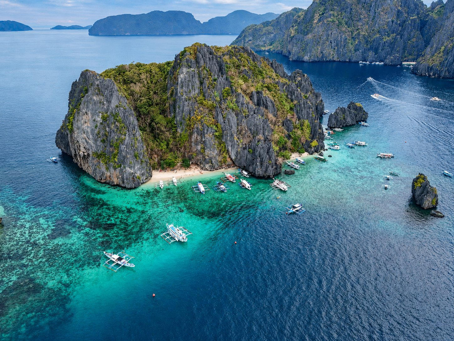
EL NIDO, PALAWANShimizu Island
Surrounded by clear tropical water and dramatic limestone formations, Shimizu Island is one of the classic stops on El Nido's Tour A island-hopping route . Its small sandy coves sit beneath steep, vegetation-covered karst cliffs, while shallow reefs around the island make it particularly attractive for swimming and snorkeling. Current El Nido Tourism information continues to include Shimizu Island among Tour A destinations. Compared with Big Lagoon, where the experience centers on kayaking through enclosed limestone scenery, Shimizu Island is more about getting into the water . Visitors typically come here to snorkel above coral areas, swim in the clear shallows, relax along the beach, and enjoy the surrounding Bacuit Bay scenery. El Nido Tourism itself promotes Shimizu as a snorkeling location and highlights its turquoise waters and limestone landscape. Because Shimizu is part of one of El Nido's most established island-hopping routes, travelers should expect other boats and visitors, particularly during favorable weather and the main travel season. It is best approached as a scenic marine stop within a full-day island-hopping experience rather than as a secluded island where visitors stay for an entire day. Best Time to Visit The generally preferred period for El Nido island hopping is November through May , when calmer seas and clearer conditions are more common. Philippine tourism guidance identifies these months as the drier period for El Nido island-hopping activities and notes that rougher seas and cancellations are more likely from June through October. Even during the drier months, good weather is never guaranteed. Conversely, visitors can still experience excellent days during the wetter season. For Shimizu Island in particular, sea conditions matter more than the calendar alone . El Nido Tourism issues operational advisories based on PAGASA forecasts and Philippine Coast Guard guidance, and recent August 2026 advisories demonstrate that tours can be cancelled or restricted when conditions become unsafe. Recommended period: November–May Best conditions to look for: Calm seas, light winds and good underwater visibility Greater chance of disruption: June–October What to Expect Shimizu Island is a small island-hopping stop , not a developed resort destination. Do not expect roads, restaurants, shops or extensive visitor facilities. Tour boats approach from Bacuit Bay and normally anchor or moor offshore. Visitors then swim, snorkel or go ashore as conditions and local arrangements allow. The beach can become busy when several Tour A boats arrive at similar times. Travelers looking for complete solitude should therefore adjust expectations; Shimizu's appeal comes primarily from its scenery and accessible marine environment rather than isolation. Snorkelers may encounter coral in relatively shallow water, so care should be taken not to stand on, kick, touch or collect coral . Water shoes can be useful for boat transfers and rocky areas, but they should never be used as justification for walking across living reef. A waterproof phone pouch or dry bag is useful because visitors should expect to get wet during boat transfers and water activities. Getting There Shimizu Island is reached by boat from El Nido and is currently included in the municipality's regular Tour A island-hopping itinerary. Current El Nido Tourism information lists Shimizu alongside other Tour A attractions, although actual stops and their sequence can change because of weather, crowd management or operational requirements. Travelers should arrange island hopping through a legitimate tour operator and confirm the day's operating status before departure, particularly during unsettled weather. Important Visitor Information El Nido's marine tourism takes place within an environmentally protected setting. The El Nido Marine Reserve was formally declared a protected area under the National Integrated Protected Areas System and became the El Nido Managed Resource Protected Area in 1998. El Nido also collects an Eco-Tourism Development Fee (ETDF) . The regular current rate for non-Palawan-resident tourists is ₱400 , with other rates applying to eligible categories. Because municipal fees can change, ToursPalawan.com should treat this as time-sensitive information rather than permanently embedding the amount in the destination description. A recent August 2026 El Nido Tourism advisory listed the regular Tour A rate at ₱1,200 per person , with Shimizu Island among its stops. This should likewise be displayed only as a current/reference price because tour rates, inclusions and additional charges can change. Travelers should confirm whether snorkeling equipment, meals, environmental fees and other charges are included in their chosen package. Responsible Travel Shimizu Island's reef environment is one of the main reasons people visit, so protecting it should be part of the visitor experience. Avoid standing or walking on coral, touching marine animals, collecting shells or coral, feeding fish, or leaving any waste behind. Keep fins away from shallow coral when snorkeling, follow your guide's designated swimming areas, and use existing boat moorings where managed by operators rather than encouraging anchoring on reef. Recommended For Especially suitable for: Snorkelers • Swimmers • Couples • Families • First-time El Nido visitors • Nature lovers • Photographers • Island-hopping travelers Consider carefully if: You are unable to transfer between boats and shallow water comfortably, cannot swim and are uncomfortable in open water, or require extensive accessibility facilities.
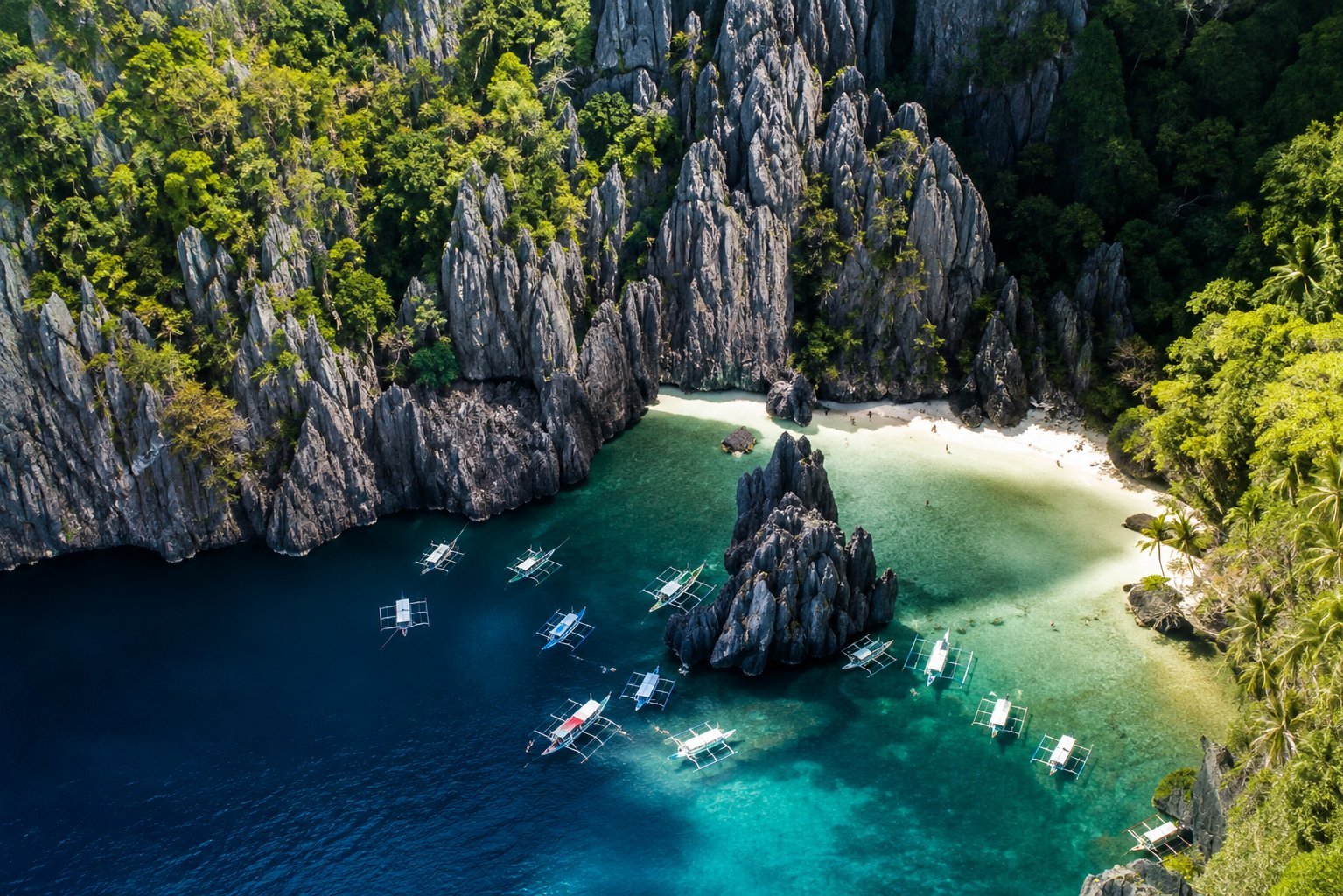
EL NIDO, PALAWANSecret Lagoon
Hidden within the limestone cliffs of Miniloc Island , Secret Lagoon is one of the distinctive natural stops on El Nido’s Tour A island-hopping route. The lagoon is reached through a small opening in the rock, giving visitors the experience of entering a secluded pool enclosed by towering limestone walls. Depending on the tide and water level, visitors may need to wade, crouch, or carefully swim through the entrance. Once inside, the lagoon is relatively small and peaceful, making the experience more about exploring the unusual limestone setting than spending a long time swimming. Secret Lagoon is best visited as part of a wider island-hopping trip around Bacuit Bay. Because the entrance is narrow and the site is popular, visitors should expect some waiting or crowding during busy periods. Best Time to Visit The generally preferred period for El Nido island hopping is November to May , when calmer seas and clearer weather are more common. Sea conditions can still change quickly, and tours may be modified or suspended when weather or maritime conditions are unsafe. The tide can also affect access to Secret Lagoon, particularly around its narrow entrance. What to Expect Secret Lagoon is a short exploration stop rather than a large swimming or kayaking destination. Expect to get wet while entering the lagoon, and be prepared to move carefully through a small natural opening. A waterproof phone pouch or dry bag is useful, along with secure water footwear and comfortable swimwear. Travelers with significant mobility limitations, difficulty crouching, or discomfort in confined spaces may find the entrance challenging. Getting There Secret Lagoon is located on Miniloc Island in Bacuit Bay and is reached by boat from El Nido. It is commonly included in Tour A island-hopping itineraries. Actual access can depend on weather, sea conditions, visitor-management rules, and protected-area regulations, so individual stops may change on the day of the tour. Responsible Travel Secret Lagoon forms part of El Nido’s environmentally sensitive marine landscape. Visitors should avoid touching or damaging limestone formations, standing on coral, collecting shells or marine life, and leaving any waste behind. Always follow the instructions of your tour guide and respect temporary closures or visitor limits when these are in place.
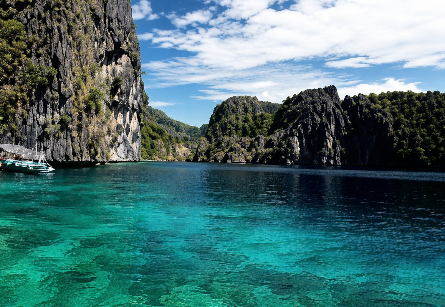
EL NIDO, PALAWANSouth Miniloc
South Miniloc , also known as Biet Point , is a well-known reef diving site off the southeastern tip of Miniloc Island in Bacuit Bay. Facing nearby Shimizu Island, the site is characterized by a reef separated from the island by a channel, with coral gardens, sponges, and abundant reef life. One of its most distinctive underwater features is a broad garden of lettuce or “cabbage” corals. Schools of reef fish are commonly associated with the site, while currents moving through the channel help support an active marine environment. Unlike El Nido’s lagoon and beach attractions, South Miniloc is primarily an underwater destination . It is best suited to travelers who want to experience the coral reefs and marine life of Bacuit Bay through scuba diving and, where local conditions allow, snorkeling. Best Time to Visit The generally preferred period for sea-based activities in El Nido is November to May , when calmer seas and clearer weather are more common. Conditions can still vary from day to day, and diving trips may be adjusted according to wind, currents, visibility, and maritime safety conditions. What to Expect South Miniloc is a boat-access dive site rather than a developed beach destination. Divers should expect a reef environment with sections affected by current, making conditions different from one visit to another. The main reef lies at relatively shallow recreational-diving depths, with PADI describing the principal formation at around 12 meters . Actual dive profiles are determined by the dive professional according to conditions and diver experience. Visibility, marine-life encounters, and current strength are never guaranteed, so visitors should treat wildlife sightings as part of a natural marine experience rather than an assured attraction. Getting There South Miniloc is reached by boat from El Nido , normally as part of an organized scuba-diving excursion with a licensed or accredited dive operator. Because this is a specific dive site rather than a standard island-hopping beach stop, travelers interested in visiting should arrange the trip directly with a dive center. Responsible Travel Avoid touching, standing on, or collecting coral and marine life. Maintain good buoyancy while diving, keep fins clear of the reef, and follow your dive guide’s instructions regarding currents, depth, and entry or exit points. South Miniloc forms part of El Nido’s environmentally sensitive marine landscape, so responsible diving is essential to protecting the reef for future visitors.
EL NIDO, PALAWANSeven Commando Beach
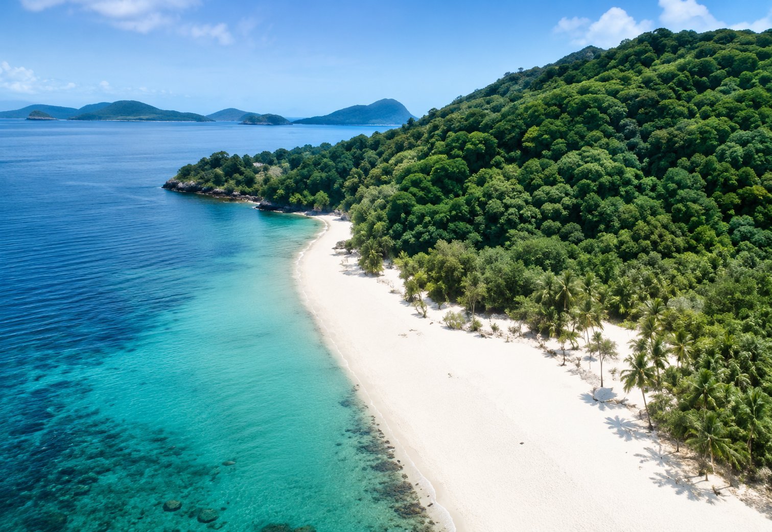
Seven Commandos Beach is a scenic white-sand beach in El Nido, framed by coconut palms, forested limestone cliffs, and the clear waters of Bacuit Bay. It is commonly included in El Nido Tour A , making it a popular place to relax after visiting the area's lagoons and snorkeling sites. Unlike stops centered on kayaking or reef exploration, Seven Commandos Beach is primarily about enjoying the shoreline. Visitors can swim in the shallows, walk along the sand, relax beneath the palms, and take in views across the bay. Because it is a well-known island-hopping stop, the beach can become lively when several tour boats arrive at the same time. Best Time to Visit The generally preferred period for visiting El Nido is November to May , when calmer seas and clearer weather are more common. From June to October, stronger winds, rain, and rougher seas can occasionally affect boat tours. Weather and sea conditions should always take priority over the season, as island-hopping activities may be modified or suspended for safety. Recent El Nido Tourism advisories demonstrate that access to Seven Commandos Beach can also be temporarily limited when conditions require it. What to Expect Expect a tropical beach setting with soft sand, coconut palms, clear water, and dramatic green cliffs behind the shoreline. The beach is popular with island-hopping groups, so it may be busy during peak visiting hours. Swimming conditions vary with the weather and sea state. Visitors should follow their boat crew or tour guide regarding safe swimming areas and use a life jacket when required. Bring swimwear, sun protection, drinking water, and a waterproof pouch or dry bag for valuables. Getting There Seven Commandos Beach is most commonly reached by boat from El Nido as part of an organized island-hopping trip and is listed among the attractions associated with Tour A. It can also be approached by kayak from the Corong-Corong side of El Nido, but independent paddling should only be attempted when weather and sea conditions are suitable and by travelers comfortable kayaking in open coastal waters. Responsible Travel Help preserve the beach by taking all waste with you, avoiding single-use plastics where possible, and keeping the shoreline and surrounding waters clean. Do not collect coral, shells, or marine life, and avoid touching or standing on coral when swimming
EL NIDO, PALAWANPapaya Beach
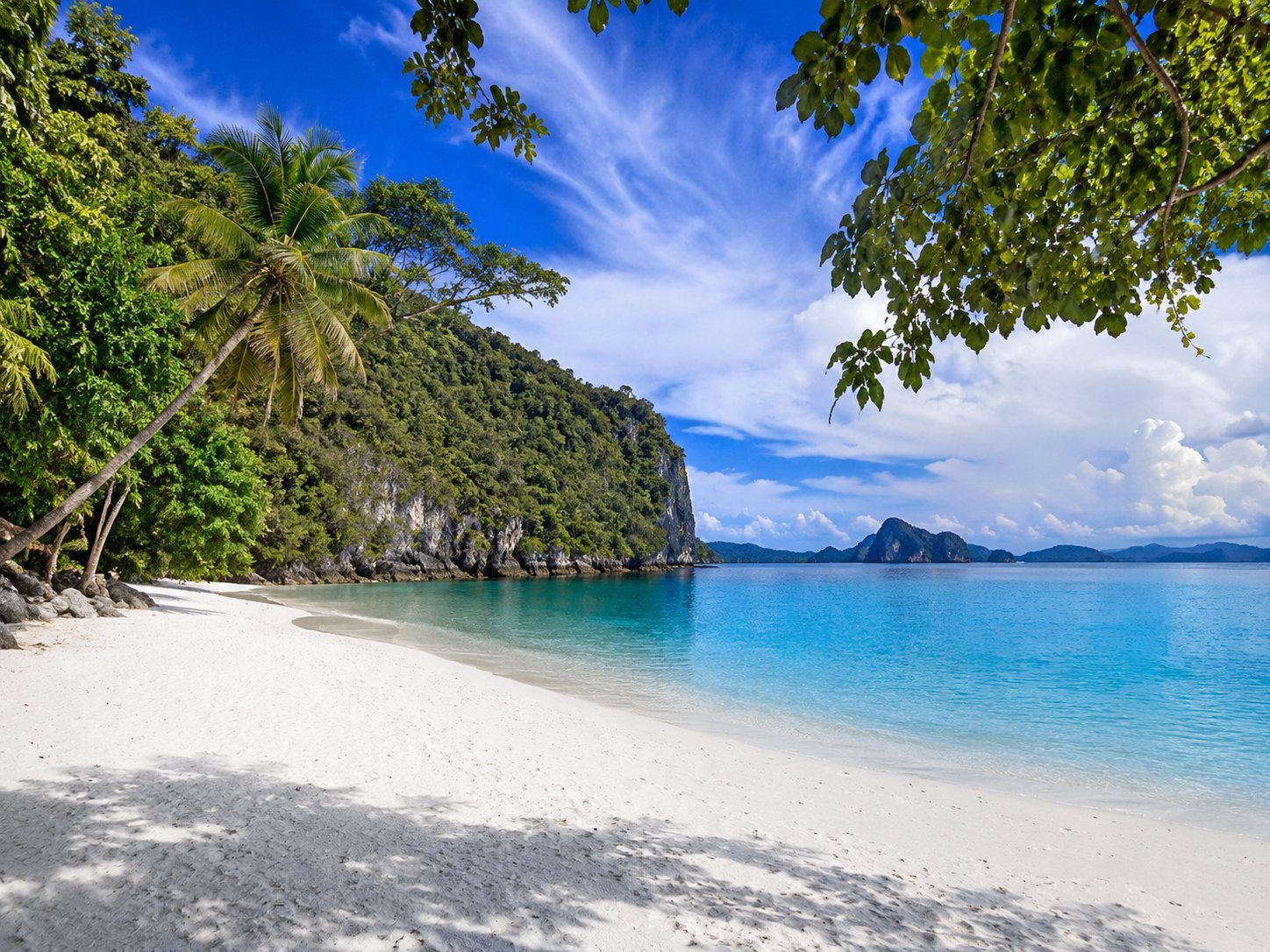
Papaya Beach is a small tropical beach along the El Nido mainland coast, close to Seven Commandos Beach and separated from it by a limestone formation. Its white-sand shoreline, coconut palms, clear water, and forested cliffs create a quiet beach setting within Bacuit Bay. Unlike many of El Nido’s better-known stops, Papaya Beach is not consistently included in the standard island-hopping itineraries. It is commonly visited by kayak or local/private boat, making it an appealing option for travelers who want to spend more time swimming, relaxing, and enjoying the coastline. Best Time to Visit November to May generally offers the most favorable conditions for coastal and island-hopping activities in El Nido, with calmer seas and clearer weather more common during this period. From June to October, stronger winds, rain, and rougher seas can affect kayaking and boat travel. What to Expect Papaya Beach is relatively undeveloped compared with major resort beaches. Expect a natural shoreline with limited facilities and fewer commercial services. The water is generally inviting for swimming when conditions are calm, while snorkeling may be possible around suitable shallow areas. Visitors arriving independently by kayak should consider wind, waves, currents, and their paddling experience before setting out. Bring drinking water, sun protection, swimwear, and a waterproof bag for valuables. Getting There Papaya Beach has no practical road access because limestone cliffs separate the shoreline from inland roads. It is reached from the sea, most commonly by kayak from the Corong-Corong area or by local/private boat. Typical kayak journeys are often reported at around 20–30 minutes in suitable conditions, although actual travel time depends on the weather, sea state, and paddling ability. Responsible Travel Keep the beach and surrounding waters clean by taking all waste with you. Avoid collecting shells, coral, or marine life, and never stand on or touch living coral while swimming or snorkeling. Respect any local access instructions and avoid kayaking or swimming when sea conditions are unsafe.
EL NIDO, PALAWANSnake Island
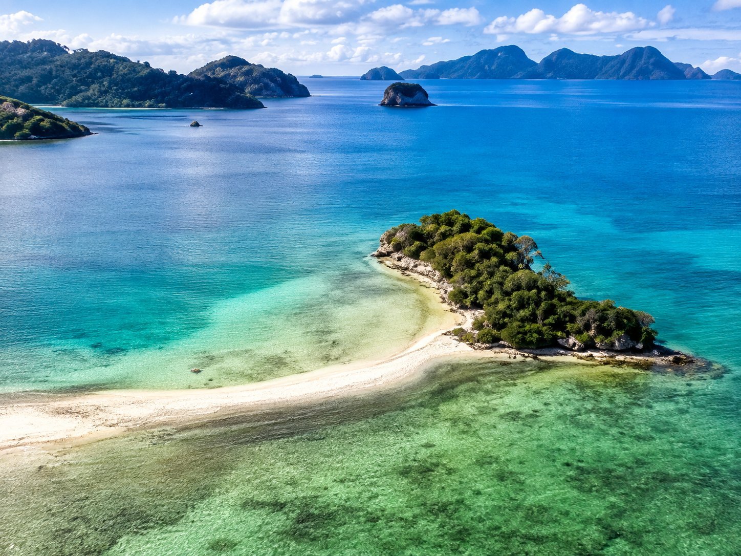
Snake Island , also known as Vigan Island , is one of El Nido’s most distinctive natural attractions. Its main feature is a long, curving S-shaped sandbar that becomes most visible during low tide, creating a natural pathway through the shallow turquoise waters. Despite its name, the island is not known for snakes—the name refers to the winding shape of its sandbar. Visitors can walk along the exposed sand, enjoy the surrounding shallow waters, and take in panoramic views of the islands and limestone landscapes of Bacuit Bay. Snake Island is a regular stop on El Nido Tour B , which focuses on caves, islands, beaches, and unusual coastal formations. Best Time to Visit The generally preferred period for visiting is November to May , when calmer seas and clearer weather are more common in El Nido. For the best Snake Island experience, low tide is especially important , as this is when the famous sandbar becomes most exposed and easier to walk along. At higher tide, part or all of the sandbar may be covered by shallow water. What to Expect Snake Island is primarily a scenic sandbar and coastal destination rather than a developed beach resort. Expect shallow water, open sun, and limited facilities. Visitors commonly walk along the sandbar, swim in the surrounding water, and enjoy the elevated views of the coastline. Because it is a popular Tour B stop, other tour groups may be present during busy periods. Bring sun protection, swimwear, drinking water, and a waterproof pouch or dry bag for valuables. Getting There Snake Island is reached by boat from El Nido and is normally visited as part of Tour B . Current El Nido Tourism advisories continue to include Snake Island among Tour B destinations. Island-hopping itineraries remain subject to weather, sea conditions, and maritime safety advisories, so individual stops may change on the day of travel. Responsible Travel Keep the sandbar and surrounding waters clean by taking all waste with you. Avoid collecting shells, coral, or marine life, and do not step on living coral in shallow areas. Follow your guide’s instructions and respect any temporary access or safety restrictions.
EL NIDO, PALAWANEntalula Island
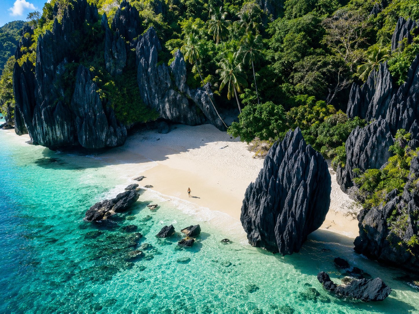
Entalula Island is a striking island-hopping destination in Bacuit Bay, known for its white-sand beach, clear turquoise water, tropical vegetation, and dramatic limestone formations. Entalula Beach is the island’s main visitor attraction and is currently included in El Nido Tour B . The beach offers a relaxing contrast to Tour B’s caves and sandbars. Visitors typically spend their stop swimming, enjoying the shoreline, snorkeling when conditions are suitable, and taking in the surrounding limestone scenery. Best Time to Visit November to May generally provides the most favorable conditions for El Nido island hopping, with calmer seas and clearer weather more common during the dry season. From June to October, rougher seas and changing weather can lead to itinerary changes or tour cancellations. What to Expect Expect a scenic tropical beach surrounded by clear water and rugged limestone cliffs. Entalula is a popular island-hopping stop, so other tour groups may be present, particularly during peak travel periods. Swimming conditions depend on the weather and sea state, while underwater visibility for snorkeling can vary naturally. Bring swimwear, sun protection, drinking water, and a waterproof pouch or dry bag for valuables. Getting There Entalula Island is reached by boat from El Nido and is commonly visited as part of Tour B , together with other island, cave, and sandbar attractions around Bacuit Bay. Actual stops and their sequence may change depending on weather, sea conditions, and local tourism or maritime-safety advisories. Responsible Travel Help protect Entalula’s marine environment by taking all waste with you and avoiding the collection of shells, coral, or marine life. When snorkeling, never touch or stand on living coral and follow your guide’s instructions around designated swimming areas.
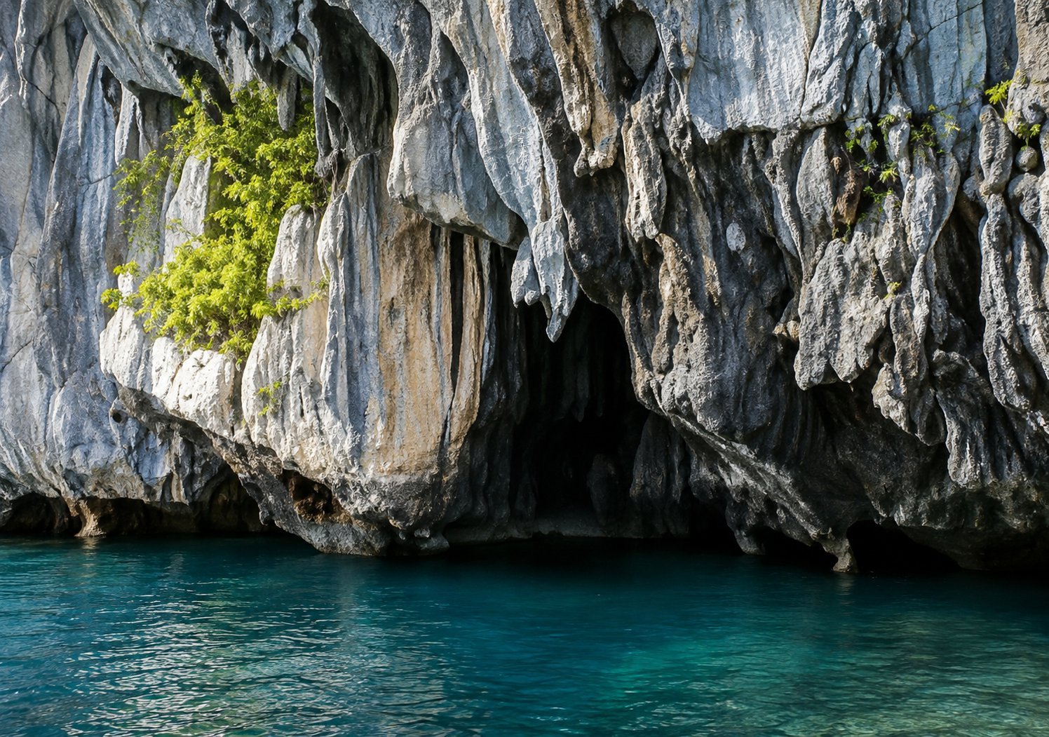
EL NIDO, PALAWANCathedral Cave
Cathedral Cave is a dramatic sea cave on Pinasil Island, named for its tall limestone entrance and soaring interior that resemble the architecture of a cathedral. Sunlight entering through the opening highlights the cave’s steep rock walls and dark blue water, creating one of the distinctive geological sights on El Nido’s Tour B island-hopping route. The attraction is primarily a sightseeing and photography stop rather than a cave visitors explore on foot. Tour boats approach the entrance so passengers can appreciate the limestone formations from the water. How closely a boat can approach depends on sea conditions and instructions from the crew. Best Time to Visit The generally preferred period for El Nido island hopping is November to May , when calmer seas and clearer weather are more common. Tours can still be changed or cancelled whenever winds and sea conditions make travel unsafe. What to Expect Expect a relatively short but visually impressive stop focused on the cave entrance and its towering limestone walls. Unlike Cudugnon Cave, Cathedral Cave is not normally an on-foot cave exploration experience. Because the site opens directly onto the sea, waves and currents can affect how close boats are able to approach. Visitors should remain within designated areas and follow their boat crew’s safety instructions. Getting There Cathedral Cave is reached by boat from El Nido and remains part of the municipality’s Tour B itinerary. Recent August 2026 El Nido Tourism advisories continue to list Cathedral Cave together with other Tour B destinations such as Snake Island and Cudugnon Cave. Tour B operations are weather-dependent and may be suspended when maritime conditions are unsafe. Responsible Travel Avoid touching, climbing, or damaging the limestone formations and never leave waste in the water or cave surroundings. Observe wildlife without disturbing it and follow all instructions from your guide and local tourism authorities.
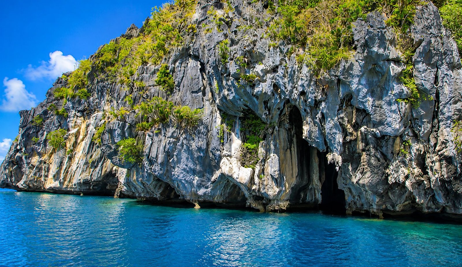
EL NIDO, PALAWANCudugnon Cave
Cadugnon Cave is one of the notable cave stops on El Nido’s Tour B and is known for both its natural beauty and archaeological importance. Hidden within limestone formations, the cave has a small entrance that visitors pass through before reaching a wider chamber inside. Beyond its striking rock formations, the cave is also recognized as an important archaeological site. Discoveries made here have linked the area to early human activity and long-distance trade, giving the cave added cultural and historical value. Cadugnon Cave is best suited to travelers who enjoy nature, light adventure, and destinations with a sense of history. Best Time to Visit The generally preferred time to visit El Nido is November to May , when calmer seas and clearer weather are more common. Boat tours may still be adjusted or cancelled depending on weather and sea conditions. What to Expect Expect a short but memorable stop focused on cave exploration. Reaching the interior usually involves passing through a narrow rock opening, so visitors may need to crouch, climb carefully, or wade through shallow water depending on conditions. Inside, the cave has a quiet atmosphere with natural rock formations and filtered light. The ground may be uneven or slippery, so secure footwear is helpful. Because of the entrance and terrain, this stop may be challenging for travelers with mobility limitations or those uncomfortable in tight spaces. Getting There Cadugnon Cave is reached by boat from El Nido and is commonly visited as part of Tour B island-hopping itineraries. Actual stops may vary depending on weather, sea conditions, and local tourism advisories. Responsible Travel Help protect the cave by avoiding contact with delicate rock formations and by not leaving any waste behind. Follow your guide’s instructions, move carefully inside the cave, and respect the site’s natural and historical significance.
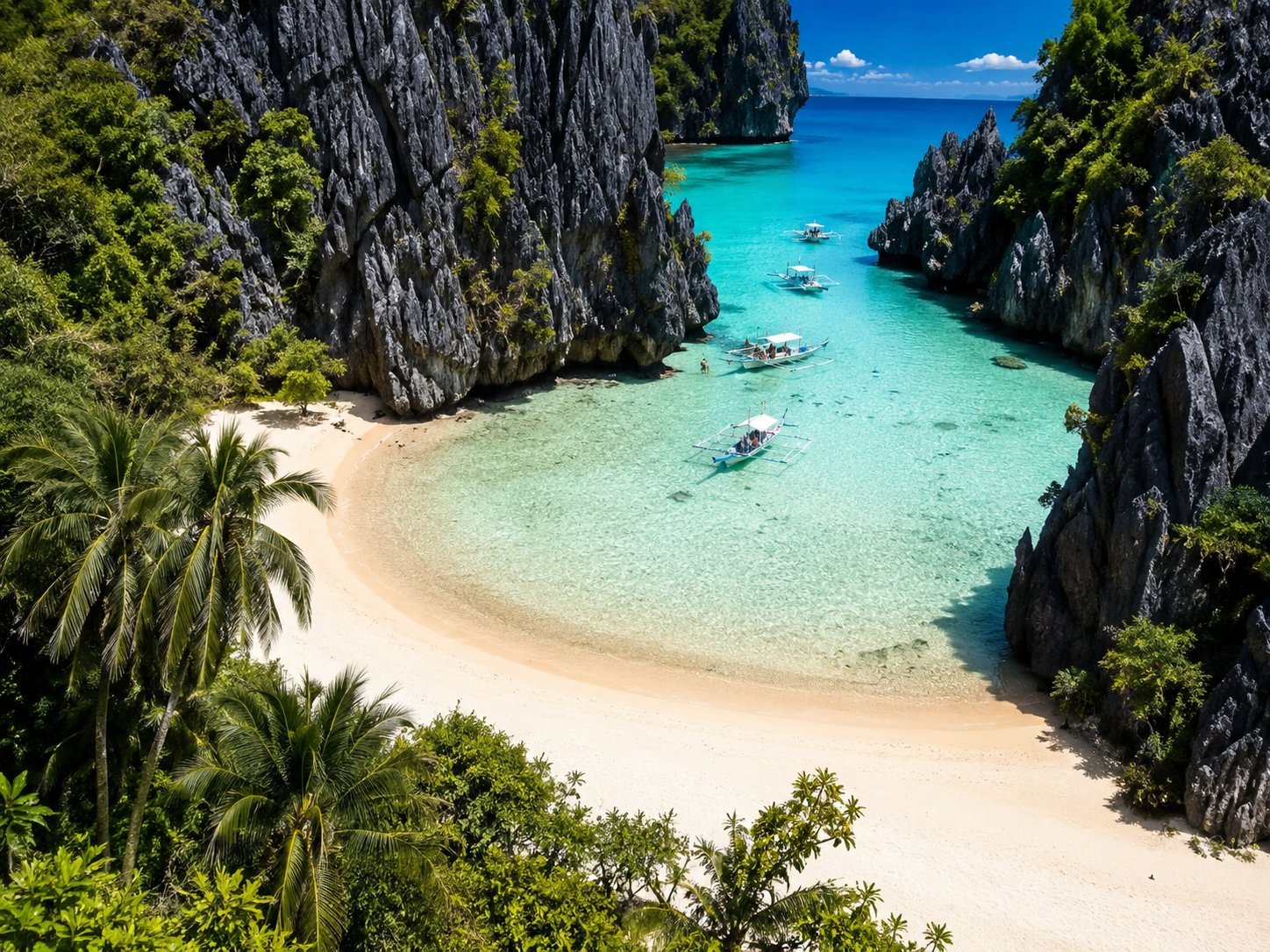
EL NIDO, PALAWANHidden Beach
Hidden Beach is a secluded white-sand cove tucked behind towering limestone formations on Matinloc Island . From the open sea, much of the beach is concealed by the surrounding karst cliffs, giving visitors the experience of discovering a sheltered tropical cove only after approaching through the narrow opening. The beach is one of the signature destinations on El Nido’s Tour C island-hopping route. Inside, visitors find shallow turquoise water, a sandy shoreline, and dramatic limestone scenery that create a noticeably enclosed setting compared with El Nido’s more open beaches. Current El Nido Tourism advisories continue to include Hidden Beach in Tour C itineraries. Best Time to Visit The generally preferred period for El Nido island hopping is November to May , when drier weather and calmer sea conditions are more common. Conditions can still change quickly, and tours may be modified or suspended when winds or waves make travel unsafe. What to Expect Tour boats normally approach the cove from outside the limestone formations. Depending on the tide and sea conditions, visitors may need to wade or swim through shallow water to reach the beach, so expect to get wet before reaching the shore. Hidden Beach is a popular Tour C attraction and may become busy when several tour groups arrive at similar times. Bring swimwear, secure water footwear, sun protection, and a waterproof pouch or dry bag for valuables. Getting There Hidden Beach is reached by boat from El Nido and is commonly visited as part of Tour C . Access and the day's itinerary remain subject to weather, sea conditions, and local tourism or maritime-safety advisories. Responsible Travel Hidden Beach lies within the El Nido Managed Resource Protected Area , established to protect the municipality’s important terrestrial and marine ecosystems. Visitors should take all waste with them, avoid touching or standing on coral, leave shells and marine life undisturbed, and follow the instructions of guides and protected-area personnel.
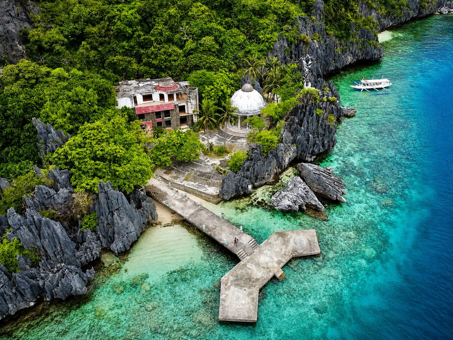
EL NIDO, PALAWANMatinloc Shrine
Matinloc Shrine is a small Marian shrine set among the limestone cliffs and turquoise waters of Matinloc Island. Built in 1982 in honor of the Virgin Mary , the site adds a cultural and historical element to El Nido’s otherwise nature-focused island-hopping experience. The shrine and its surrounding structures are no longer an active religious complex in the way they once were, but the site remains known for its distinctive architecture, coastal setting, and elevated viewpoints overlooking the surrounding islands and sea. Matinloc Shrine continues to be included among the destinations associated with El Nido Tour C , together with beaches and snorkeling locations around Matinloc and Tapiutan islands. Best Time to Visit The generally preferred period is November to May , when calmer seas and clearer weather are more common in El Nido. From June to October, stronger winds and rougher seas can result in itinerary changes or tour cancellations. What to Expect Expect a relatively short sightseeing stop rather than a full beach experience. Visitors can explore the shrine area and, where access is permitted, climb toward elevated viewpoints for panoramic views of Matinloc Island and the surrounding seascape. The climb can be steep and rocky, so secure footwear is recommended. Some structures are weathered, and visitors should avoid entering restricted or unsafe areas. An additional entrance charge may apply for access to the shrine and is not always included in Tour C packages, so travelers should confirm current fees with their tour operator before departure. Getting There Matinloc Shrine is reached by boat from El Nido and is commonly visited as part of Tour C . Tour operations and individual stops remain subject to weather, sea conditions, and Philippine Coast Guard or local tourism advisories. Responsible Travel Respect the shrine as a cultural site and avoid climbing on or damaging its structures. Keep the surrounding beach and waters free of waste, stay on established paths where possible, and follow your guide’s instructions around rocky viewpoints and protected areas.
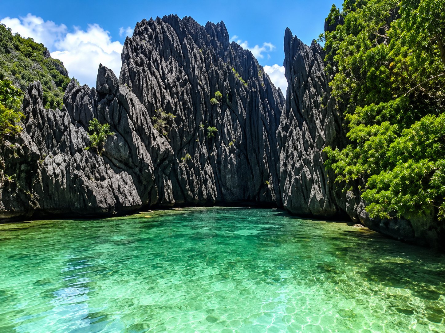
EL NIDO, PALAWANSecret Beach
Hidden behind the limestone cliffs of Matinloc Island , Secret Beach is one of El Nido’s most distinctive coastal attractions. The small sandy cove is concealed from the open sea and is traditionally reached by swimming through a narrow opening between the limestone rocks , making the journey into the beach part of the experience. Inside, visitors are greeted by clear water, a compact sandy shoreline, and towering limestone walls that create a sheltered, enclosed setting. Secret Beach is associated with El Nido’s Tour C , which explores beaches and marine attractions around Matinloc and nearby islands. Best Time to Visit November to May generally offers more favorable conditions for island hopping in El Nido, with calmer seas more common during this period. For Secret Beach, however, the day’s waves, currents, and tide are particularly important because visitors normally have to swim through the rocky entrance. What to Expect Expect to get wet before reaching the beach. Visitors normally leave the tour boat outside the cove and swim through the limestone opening while wearing a life jacket and following their guide’s instructions. Access can become difficult or unsafe when waves are strong, and Secret Beach may be removed from an itinerary when conditions or protected-area management require it. Recent El Nido Tourism advisories have also shown that access arrangements for Secret Beach can change, so visitors should confirm availability with their tour operator before departure. Getting There Secret Beach is located on Matinloc Island and is reached by boat from El Nido town. It is traditionally visited through Tour C or a private island-hopping tour that includes the Matinloc area. Responsible Travel Secret Beach is within the wider El Nido Managed Resource Protected Area , established to conserve the area’s important terrestrial and marine environments. Visitors should avoid touching or standing on coral, collecting shells or marine life, damaging limestone formations, or leaving waste behind.
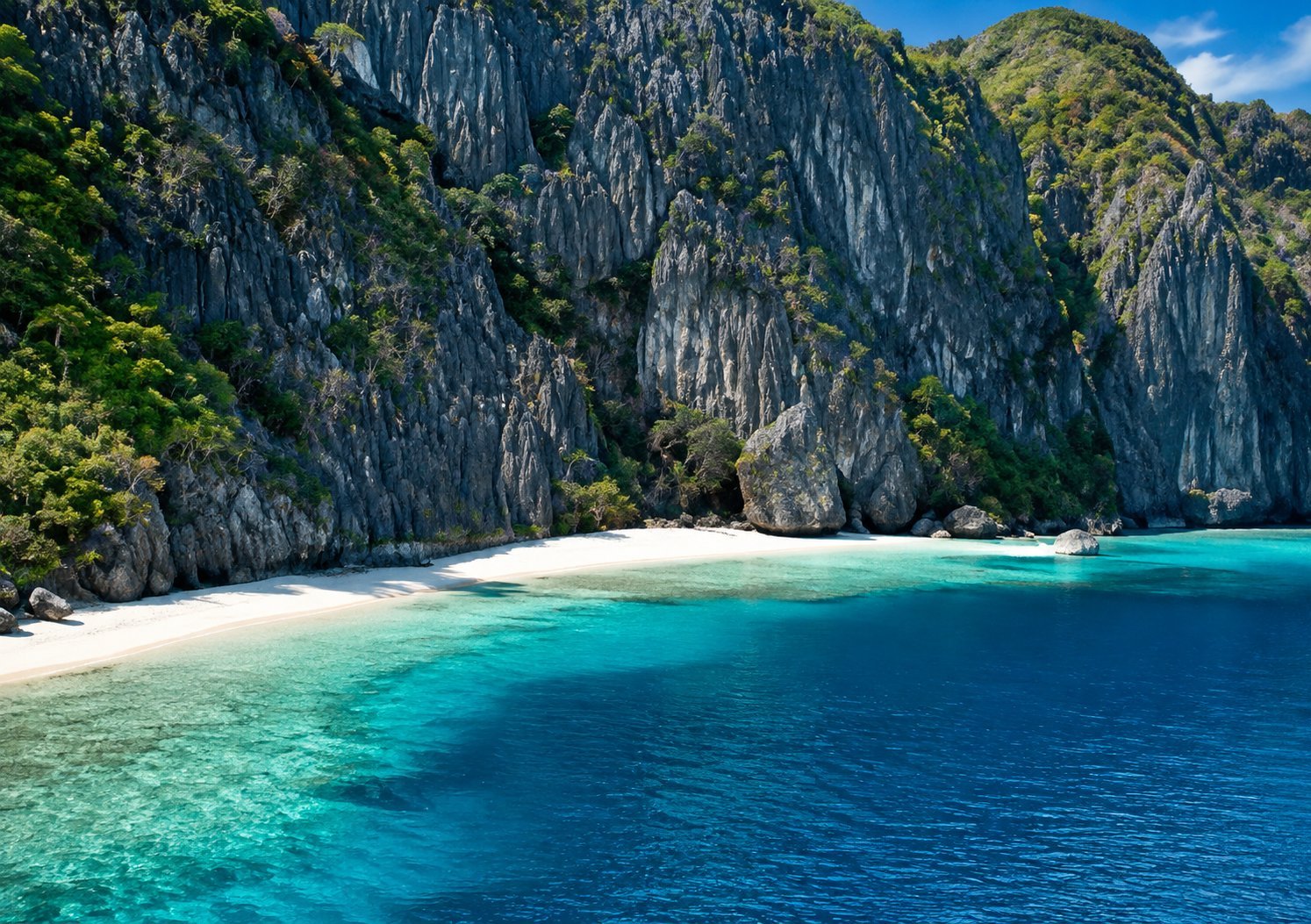
EL NIDO, PALAWANTalisay Beach
Talisay Beach is a small white-sand beach on Tapiutan Island , surrounded by clear water, tropical vegetation, and El Nido’s distinctive limestone scenery. It is commonly visited on Tour C and is known as a relaxing beach stop between the route’s more active swimming and sightseeing destinations. The shallow coastal waters make the area suitable for swimming, while nearby reef areas can offer snorkeling opportunities when visibility and sea conditions are favorable. Talisay Beach is also traditionally used by some island-hopping groups as a lunch or rest stop during the day. Best Time to Visit November to May generally offers the most favorable conditions for island hopping in El Nido, with calmer seas and clearer weather more common during the dry season. From June to October, stronger winds and rougher seas can result in itinerary changes or tour cancellations. What to Expect Expect a relatively small and natural beach rather than a developed resort area. Facilities are limited, and several tour boats may arrive during popular visiting times. Swimming and snorkeling conditions vary with the weather, tide, and water visibility. Bring swimwear, sun protection, drinking water, and a waterproof pouch or dry bag for valuables. Getting There Talisay Beach is reached by boat from El Nido and is currently included among destinations used for Tour C . Recent August 2026 El Nido Tourism advisories continue to list Talisay Beach as an authorized Tour C stop, although itineraries can change according to weather, vessel restrictions, and protected-area management. Responsible Travel Help protect the beach and surrounding marine environment by taking all waste with you, avoiding single-use plastics where possible, and never touching or standing on living coral. Leave shells and marine life undisturbed and follow your guide’s instructions around swimming and snorkeling areas.
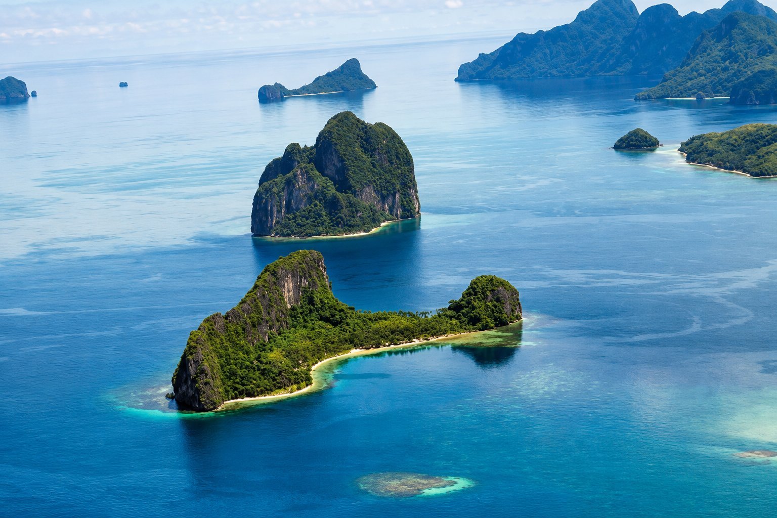
EL NIDO, PALAWANHelicopter Island
Helicopter Island , also known as Dilumacad Island , is one of El Nido’s recognizable island landmarks, named for the silhouette of its limestone cliffs, which can resemble a helicopter when viewed from a distance. The island features a sandy beach, clear coastal waters, and steep vegetation-covered limestone formations typical of Bacuit Bay. The surrounding reef makes Helicopter Island a popular stop for snorkeling and swimming , while the beach provides a scenic place to relax between island-hopping activities. El Nido Tourism identifies the area as a snorkeling destination with coral reef cover. Helicopter Island is commonly associated with El Nido Tour C , although actual stops can change depending on weather, sea conditions, and local tourism advisories. Best Time to Visit November to May generally offers the most favorable conditions for island hopping in El Nido, with calmer seas and drier weather more common during this period. Conditions can still change quickly, so boat trips and snorkeling activities remain dependent on the day’s weather and maritime-safety advisories. What to Expect Expect a natural island stop centered on swimming, snorkeling, and beach scenery rather than extensive visitor facilities. Several tour boats may arrive during popular hours, particularly during the main travel season. Snorkeling visibility and water conditions vary with the tide, wind, and weather. Bring swimwear, sun protection, and a waterproof pouch or dry bag for valuables. Getting There Helicopter Island is reached by boat from El Nido and is commonly visited as part of Tour C or a private island-hopping itinerary. Local tourism advisories may also refer to the destination by its original name, Dilumacad Island or Dilumacad Beach . Responsible Travel Avoid touching, standing on, or collecting coral and marine life while snorkeling. Keep fins clear of shallow reefs, take all waste with you, and follow your guide’s instructions regarding swimming areas and changing sea conditions.
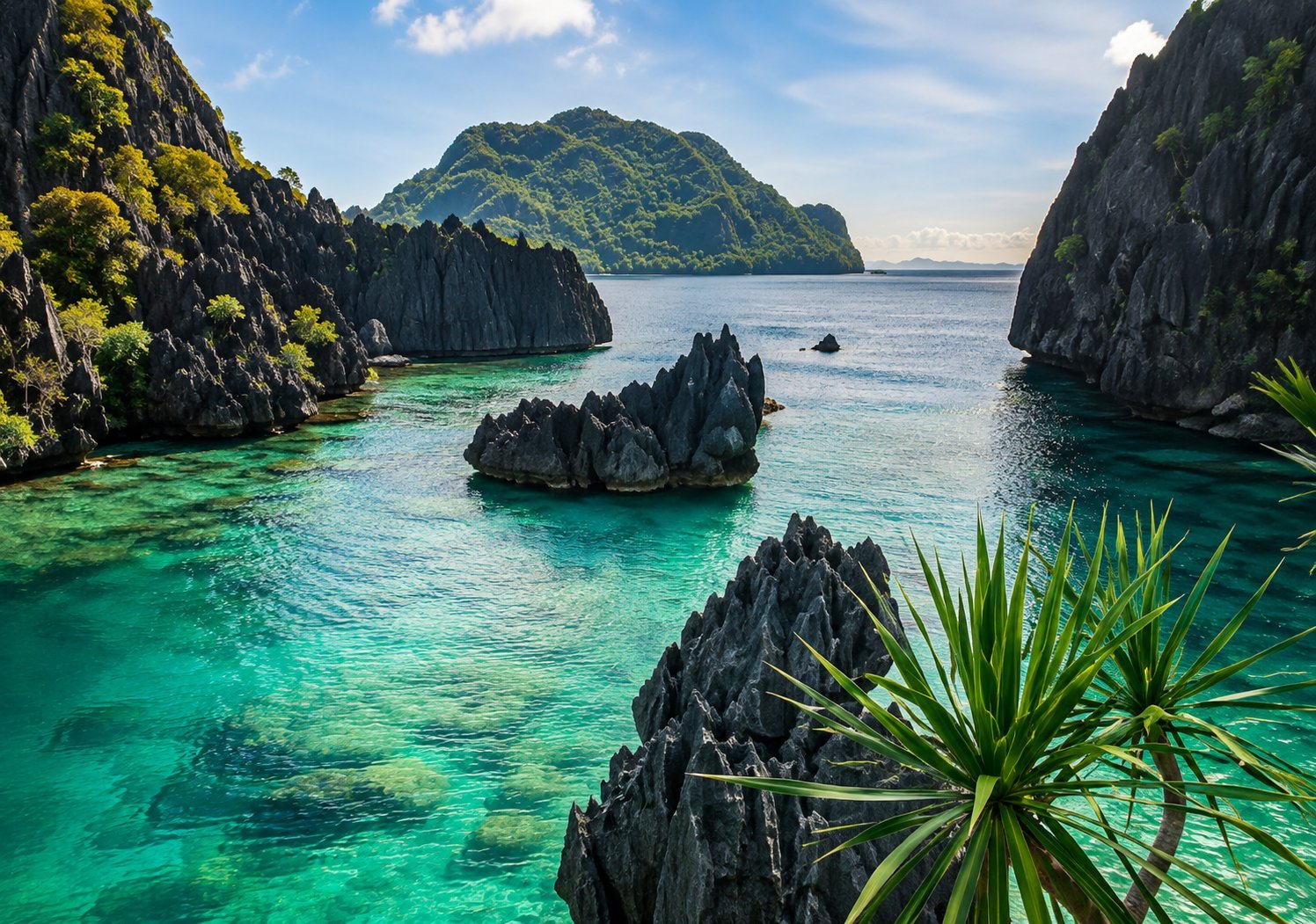
EL NIDO, PALAWANCadlao Lagoon
Cadlao Lagoon is a scenic turquoise lagoon tucked beneath the steep limestone cliffs and dense tropical vegetation of Cadlao Island. Its sheltered waters, rocky karst formations, and small sandy areas create a quieter lagoon experience within El Nido’s Bacuit Bay. El Nido Tourism continues to feature Cadlao Lagoon as one of the principal destinations around Cadlao Island. The lagoon is especially suited to kayaking and swimming , allowing visitors to explore its shallow clear waters and limestone surroundings at a relaxed pace. Snorkeling may also be possible in suitable areas when visibility and sea conditions are favorable. Cadlao Lagoon is currently associated with El Nido Tour D , together with other beaches and coves around Cadlao Island. Best Time to Visit November to May generally offers the most favorable conditions for island hopping in El Nido, with calmer seas and clearer weather more common during this period. From June to October, stronger winds and rougher seas can lead to itinerary changes or tour cancellations. What to Expect Expect a natural lagoon surrounded by rugged limestone cliffs rather than a developed tourist facility. Visitors usually spend their stop swimming, paddling, or simply enjoying the scenery. Water depth and clarity vary throughout the lagoon, and conditions can change with the tide, wind, and weather. Bring swimwear, sun protection, secure water footwear, and a waterproof pouch or dry bag for valuables. Getting There Cadlao Lagoon is reached by boat from El Nido and is commonly included in Tour D or private island-hopping trips around Cadlao Island. Current El Nido Tourism information lists Cadlao Lagoon together with destinations such as Nat Nat Beach and Pasandigan Cove. Tour operations remain subject to daily sea conditions and Philippine Coast Guard safety advisories. Responsible Travel Help preserve the lagoon by taking all waste with you and avoiding contact with coral, marine life, and limestone formations. Do not stand on living coral while swimming or snorkeling, and always follow your guide’s instructions regarding safe areas and protected-site regulations.
EL NIDO, PALAWANNat-Nat Beach
Nat-Nat Beach is a quiet beach stop around Cadlao Island , known for its pale sand, clear coastal water, and lush tropical backdrop. It forms part of El Nido’s Tour D , a route that explores beaches, coves, and lagoons around Cadlao Island. Current El Nido Tourism listings continue to include Nat-Nat Beach among Tour D destinations. The beach offers a relaxed setting for swimming and resting between island-hopping stops, while nearby waters are also associated with marine life and snorkeling opportunities. Best Time to Visit November to May generally offers the most favorable conditions for island hopping in El Nido, with calmer seas and clearer weather more common during the dry season. From June to October, rougher seas and changing weather can lead to itinerary changes or cancellations. What to Expect Expect a natural beach with limited facilities rather than a developed resort area. The atmosphere is generally more relaxed than El Nido’s busiest island-hopping stops, although several boats may still arrive during popular hours. Swimming and snorkeling conditions depend on the day’s tide, wind, visibility, and sea state. Bring swimwear, sun protection, drinking water, and a waterproof pouch or dry bag for valuables. Getting There Nat-Nat Beach is reached by boat from El Nido and is commonly visited as part of Tour D , together with Cadlao Lagoon, Pasandigan Cove, Paradise Beach, and other nearby stops. Exact itineraries remain subject to weather conditions and Philippine Coast Guard or local tourism advisories. Responsible Travel Nat-Nat Beach lies within El Nido’s protected marine landscape. Visitors should take all waste with them, avoid touching or standing on coral, leave shells and marine life undisturbed, and follow their guide’s instructions while swimming or snorkeling. The wider El Nido marine area is formally protected as the El Nido Managed Resource Protected Area .
EL NIDO, PALAWANSmall Lagoon
Small Lagoon is a sheltered turquoise lagoon hidden among the towering limestone cliffs of Miniloc Island . Smaller and more enclosed than nearby Big Lagoon, it features calm waters, narrow passages, and dramatic karst formations that are best explored by kayak. The inner lagoon is reached through a narrow opening in the limestone, creating a more intimate paddling experience. Access to Small Lagoon is regulated to help protect its sensitive environment. Visitor capacity is controlled, and motorized tour boats are restricted from anchoring directly at the lagoon entrance. Current El Nido Tourism information treats Small Lagoon as a premium lagoon destination , with access arranged through authorized island-hopping tours. Best Time to Visit November to May generally offers the most favorable conditions for visiting El Nido, when calmer seas and clearer weather are more common. From June to October, stronger winds and rougher seas can affect boat and lagoon activities. Daily weather and maritime conditions remain important, and tours may be modified or suspended when conditions are unsafe. Recent El Nido Tourism advisories continue to apply these safety restrictions when necessary. What to Expect Expect a kayaking-focused lagoon experience surrounded by steep limestone walls and clear blue-green water. Visitors normally transfer from their tour boat to a kayak before exploring the lagoon. Because Small Lagoon has controlled visitor capacity, access may require advance arrangements or a reserved slot. Kayak rental may also be charged separately depending on the tour package. Bring swimwear, sun protection, secure water footwear, and a waterproof pouch or dry bag for valuables. Getting There Small Lagoon is reached by boat from El Nido to Miniloc Island, followed by kayak or swimming where permitted. Current tourism arrangements offer Small Lagoon through a premium lagoon tour option , and local rules manage visits separately from Big Lagoon to reduce pressure on these popular sites. Responsible Travel Small Lagoon lies within El Nido’s protected marine landscape. Avoid touching or standing on coral, climbing or damaging limestone formations, collecting marine life, or leaving waste behind. Respect carrying-capacity limits, designated kayak routes, and instructions from guides and protected-area personnel. These measures help reduce the environmental impact of tourism on the lagoon.
EL NIDO, PALAWANParadise Beach
Paradise Beach is a tropical beach on Cadlao Island , known for its pale sand, clear coastal water, dense greenery, and limestone scenery. It offers a relaxed beach experience compared with El Nido’s more activity-focused lagoon and cave destinations. El Nido Tourism currently lists Paradise Beach as one of the regular stops on Tour D . Visitors typically come here to swim, relax along the shoreline, and enjoy the surrounding scenery. Tour D is generally centered on the quieter beaches, coves, and lagoons around Cadlao Island. Best Time to Visit November to May generally offers the most favorable conditions for El Nido island hopping, with calmer seas and clearer weather more common during this period. From June to October, rougher seas and changing weather can lead to tour cancellations or itinerary changes. What to Expect Expect a natural beach setting with limited facilities rather than a developed resort. The main experience is enjoying the shoreline, swimming, and taking in the surrounding Cadlao Island scenery. Because Paradise Beach is part of an established island-hopping route, other tour boats may arrive during the day. Bring swimwear, sun protection, drinking water, and a waterproof pouch or dry bag for valuables. Getting There Paradise Beach is reached by boat from El Nido and is commonly included in Tour D , together with destinations such as Cadlao Lagoon, Nat-Nat Beach, and Pasandigan Cove. Exact stops can change depending on weather, sea conditions, and maritime-safety advisories. Responsible Travel Paradise Beach lies within El Nido’s wider protected marine landscape. Visitors should take all waste with them, avoid disturbing marine life, and never touch or stand on living coral. The El Nido marine area is formally protected as the El Nido Managed Resource Protected Area .
EL NIDO, PALAWANPasandigan Cove
Pasandigan Cove is a scenic beach and sheltered cove on the southwestern side of Cadlao Island . Surrounded by steep limestone cliffs, dense tropical vegetation, and clear coastal waters, it offers a quieter setting within El Nido’s Bacuit Bay. The cove is particularly suited to swimming, snorkeling, and relaxing along the shoreline. Its shallow coastal waters and nearby reef areas provide opportunities to observe marine life when visibility and sea conditions are favorable. Pasandigan Cove is currently included among the destinations associated with El Nido Tour D , together with Cadlao Lagoon, Nat-Nat Beach, Paradise Beach, and other stops around Cadlao Island. Best Time to Visit November to May generally offers more favorable conditions for sea activities in El Nido, with calmer weather and seas more common during this period. Conditions can still change quickly, and island-hopping trips may be adjusted or cancelled for safety. What to Expect Expect a natural beach environment with limited facilities and a backdrop of forested limestone cliffs. The cove is generally visited as a short swimming, snorkeling, or relaxation stop during an island-hopping tour. Water clarity, currents, and snorkeling conditions vary with the weather and tide. Bring swimwear, sun protection, drinking water, and a waterproof pouch or dry bag for valuables. Getting There Pasandigan Cove is reached by boat from El Nido and is commonly visited as part of Tour D or a private trip around Cadlao Island. Actual stops may change depending on weather, sea conditions, and local maritime or tourism advisories. Responsible Travel Keep the beach and surrounding waters clean by taking all waste with you. Avoid touching or standing on coral, collecting shells or marine life, and disturbing wildlife. Follow your guide’s instructions when swimming or snorkeling.
CORON, PALAWANKayangan Lake
Kayangan Lake is a brackish inland lake on Coron Island, known for its clear water, surrounding limestone formations, and scenic viewpoint overlooking the coastal waters of Coron Island. It is located within Banuang Daan, one of the two barangays covering Coron Island. The island is part of the ancestral domain of the Calamian Tagbanwa, whose customary management and cultural traditions remain important to the area. Coron Island Natural Biotic Area is also included in the Philippines’ UNESCO World Heritage Tentative List, although it is not currently a UNESCO World Heritage Site .
CORON, PALAWANCYC Beach
CYC Beach, also known as Coron Youth Club Beach, is a small beach on CYC Island , an islet in the coastal waters of Coron. The Coron Environmental Conservation and Natural Resources Management Plan identifies CYC Island as one of the islands under the jurisdiction of Barangay Lajala . The Municipal Government of Coron also records a marine protected area (MPA) guardhouse on CYC Island. CYC Beach is characterized by a small sandy shoreline, shallow coastal waters, mangrove vegetation, and views of the surrounding islands and limestone landscapes. It is commonly visited as a stop during Coron island-hopping trips.
CORON, PALAWANAtwayan Beach
Atwayan Beach is a small sandy beach on Coron Island, a limestone island within the municipality of Coron. The beach is set in a sheltered coastal cove surrounded by the island’s characteristic limestone landscape and is commonly visited as a stop on Coron island-hopping itineraries, particularly for lunch and beach time. Coron Island is divided into the barangays of Banuang Daan and Cabugao and forms part of the Tagbanua ancestral domain. It is also included in the UNESCO World Heritage Centre’s Tentative List as the Coron Island Natural Biotic Area .
CORON, PALAWANLas Islas De Coral
Las Islas De Coral is a shallow-water coral reef and snorkeling site in the Coron island-hopping area, located close to CYC Beach. The site is characterized by coral formations and marine life visible in the surrounding coastal waters and is commonly included as a reef stop on Coron Island tour itineraries. Recent tour descriptions consistently identify Las Islas De Coral as a snorkeling location, while the Coron Ecological and Coastal Assessment and Resource Management Plan identifies CYC Island among the islands under the jurisdiction of Barangay Lajala.
CORON, PALAWANQuinn Reef
Quinn Reef—also spelled Quin Reef in many Coron tour references—is a shallow coral-reef site associated with Coron Island and commonly visited during Coron Island-hopping tours. Sources describe the reef as being near Sunset Beach and featuring shallow waters where visitors can observe corals and marine life. It is primarily known as a snorkeling site , rather than a beach or land-based attraction. The reef is reached by boat as part of island-hopping itineraries from Coron. Available references consistently place Quin/Quinn Reef within the Coron Island tourism circuit, although a specific official barangay designation for the reef itself could not be independently verified.
CORON, PALAWANGreen Lagoon
Green Lagoon is a coastal lagoon on Coron Island, within Barangay Banuang Daan in the municipality of Coron. It is known for its green-toned waters enclosed by steep limestone formations and vegetation. The Municipality of Coron specifically identifies Green Lagoon as being on Coron Island in Barangay Banuang Daan. Coron Island itself has a rugged karst landscape and is home to Indigenous Tagbanua communities; the island and its surrounding waters have also been subject to various conservation and protection measures. Coron Island Natural Biotic Area is included in the Philippines' UNESCO Tentative List, rather than the current World Heritage List.
CORON, PALAWANBarracuda Lake
Barracuda Lake, also known locally as Luluyuwan Lake , is an inland lake on Coron Island in the Municipality of Coron, Palawan. It is surrounded by steep limestone formations characteristic of Coron Island's karst landscape. The lake is particularly known for its unusual combination of freshwater and saltwater layers, which produce noticeable changes in water temperature and density as visitors descend. The Philippine Clearing-House Mechanism under the DENR Biodiversity Management Bureau lists Barracuda Lake as an inland wetland in Coron. The lake is also within the ancestral domain of the Calamian Tagbanwa, whose traditional management and cultural practices are important to the area.
CORON, PALAWANSmith Beach
Smith Beach, also known as Smith Point Beach, is a small coastal beach on Coron Island in the municipality of Coron, Palawan. It is recognized as one of the stops used in Coron island-hopping itineraries and is commonly used as a beach and lunch stop. The beach has a sandy shoreline and clear coastal waters, with a separate nearby monitoring station identified as Smith Beach Corals . The Department of Environment and Natural Resources (DENR) Environmental Management Bureau recorded Smith Beach among Coron Bay's island destinations and reported that its 2025 water-quality monitoring result met the applicable guideline for Class SB waters.
CORON, PALAWANSkeleton Wreck
Skeleton Wreck is a shallow underwater wreck site located off the northwest side of Coron Island in the municipality of Coron. The wreck is the remains of a small steel-hulled boat, with much of its outer structure weathered away and its keel, ribs, and stringers still visible. Dive references place the wreck along a reef slope from roughly 5–7 meters to about 22 meters deep, making it accessible to both snorkelers and divers depending on conditions and ability. Coron Island is part of the Tagbanua ancestral domain and is included in the Coron Island Natural Biotic Area , which is on the UNESCO World Heritage Tentative List.
CORON, PALAWANTwin Lagoon
Twin Lagoon is a pair of interconnected coastal lagoons on Coron Island, surrounded by steep limestone karst formations. The two bodies of water are separated by a narrow limestone wall, with access between them changing according to the tide. The site is characterized by clear blue-green water, dramatic rock walls, and noticeable changes in water temperature as warmer seawater mixes with cooler water. Twin Lagoon is a recognized tourism attraction in the Municipality of Coron and is commonly visited as part of Coron Island boat tours.
CORON, PALAWANReef Garden
Reef Garden, commonly associated with Malwawey Reef/Malwawey Coral Garden , is a shallow marine reef site along the coast of Coron Island. The site is characterized by coral formations and marine life and is used as a snorkeling stop on Coron island-hopping itineraries. The Tourism Promotions Board has included Malwawey Reef and Coral Garden in official Coron familiarization-tour itineraries, with snorkeling listed as an activity. Coron Island itself is divided into the barangays of Banuang Daan and Cabugao and is an important area of Tagbanua ancestral territory.
CORON, PALAWANSiete Pecados
Siete Pecados Marine Park is a cluster of seven small islets located between the Coron mainland and northwestern Coron Island. The islets are surrounded by shallow reef flats and fringing reefs containing soft and hard corals and diverse reef fish. The marine park was formally established through Municipal Ordinance No. 7-A in 2005, with an amended ordinance in 2007. It is managed as a community-supported marine protected area with zones regulating tourism and other activities. In 2024, Siete Pecados Marine Park received a Silver-level Blue Park Award for marine conservation, recognizing its management and biodiversity protection.
CORON, PALAWANMalwawey Beach
Malwawey Beach is a small white-sand beach on Malwawey Island, located just off the western coast of Coron Island in northern Palawan. The beach is known for its fine white sand, clear turquoise water, and nearby coral reef, making it a common stop on some Coron island-hopping itineraries. Facing Atwayan Beach across a narrow channel, Malwawey combines a quiet shoreline with a shallow coral garden that supports marine life typical of the Coron Island protected seascape. Its natural setting is characterized by limestone cliffs, coastal vegetation, and calm waters during favorable weather conditions.
Coral Garden
Coral Garden is a shallow coral-reef attraction in the coastal waters of Coron, known for its concentration of reef corals and associated marine life. However, “Coral Garden” is used for several different reef sites around Coron , so the name should be treated carefully. The Palawan Council for Sustainable Development specifically identifies Balinsasayaw Coral Garden in Barangay Lajala, Coron , while the Philippine News Agency has also documented a Sea Coral Garden near CYC Island in Barangay Lajala .
CORON, PALAWANMalcapuya Island
Malcapuya Island is a beach destination within the Municipality of Coron, Palawan, administratively associated with Barangay Bulalacao . The Coron Municipal Government and the Palawan Council for Sustainable Development (PCSD) identify Malcapuya among the islands under Bulalacao’s jurisdiction. The island is characterized by a long sandy shoreline and surrounding coastal waters with coral and other marine habitats. Malcapuya is commonly visited as part of Coron island-hopping itineraries, including trips that combine it with other islands in the southern Coron area. The surrounding marine environment is also subject to local conservation efforts, including the Bulalacao marine protected area.
CORON, PALAWANDitaytayan
Ditaytayan Island is a small island in the Bulalacao island group of Coron, Palawan, known for its long sandbar, white-sand shoreline, and shallow coastal waters. The island lies off the southeastern side of Culion Island and forms part of the island destinations commonly visited from Coron by boat. Its distinctive feature is the prominent sandbar extending from the island, creating an open coastal landscape that changes in appearance with the tide. Ditaytayan is also associated with the Bulalacao Marine Protected Area (MPA) , a community-managed marine conservation area established in 2014.
Coco Beach
Coco Beach is a coastal beach destination on Bulalacao Island , within Barangay Bulalacao in the Municipality of Coron, Palawan. The beach is characterized by a sandy shoreline bordered by coconut trees, with shaded areas and simple beach shelters used by visitors. It is commonly included in Coron island-hopping itineraries together with destinations such as Malcapuya Island and Ditaytayan Sandbar. The geographic location is supported by the Palawan Council for Sustainable Development's Coron resource-management plan, which identifies Bulalacao Island under Barangay Bulalacao. Coco Beach and other tourism establishments in the area are also associated with the Bulalacao Marine Protected Area , a community-managed marine conservation area.
Banana Island
Banana Island, also known as Isla de Saging , is a small island beach destination administered under Barangay Bulalacao in the Municipality of Coron, Palawan. The Coron Ecological Critical Areas Network (ECAN) Resource Management Plan specifically lists Banana Island among the islands under Bulalacao's jurisdiction. The island is part of the southern Coron island-hopping area and is commonly included in the Coron Island Escapade itinerary together with destinations such as Malcapuya, Ditaytayan, and Bulog Dos. The Tourism Promotions Board Philippines also identifies Banana Island as a destination for this excursion, with snorkeling included in the documented tour program.
CORON, PALAWANBulog Dos
Bulog Dos is a small island and sandbar destination in the Calamianes group of Palawan, within the municipality of Coron. It lies near the northern end of Bulalacao Island and the Malaroyroy Peninsula, in the waters between Coron and Culion. The destination is characterized by a narrow white-sand formation, shallow clear waters, and a small elevated rocky area that provides views of the surrounding sea and islands. Bulog Dos is commonly included in Coron’s island-escapade itineraries, particularly alongside Malcapuya Island and Banana Island. Its sandbar is strongly influenced by the tide and may be partly or completely submerged during higher tides.
CORON, PALAWANPass Island
Pass Island is a small island in the Calamianes group of Palawan, located off the western side of Busuanga Island and commonly visited through island-hopping trips marketed from Coron. A DENR-CENRO-based resource management plan for Busuanga lists Pass Island among the municipality's small islands and islets, with a recorded land area of approximately 11.82 hectares. The island is characterized by a white-sand beach, clear coastal waters, coconut vegetation, and a shallow nearshore reef area. Although often promoted as a “Coron” destination because tours depart from Coron, Pass Island is geographically associated with the Municipality of Busuanga, not the Municipality of Coron.
CORON, PALAWANLusong Gunboat
Lusong Gunboat is a shallow World War II-era shipwreck located off the eastern side of Lusong Island in Coron Bay. The wreck is identified as either a gunboat or submarine chaser and lies in relatively shallow water, with its stern capable of breaking the surface at low tide. Over time, hard corals have colonized the wreck, providing habitat for various marine life. Its shallow setting makes the site particularly suitable for snorkeling, while divers can also explore the underwater wreck. Official planning documents for Coron identify Lusong Island as being under the jurisdiction of Barangay Bintuan .
CORON, PALAWANMaquinit Hot Spring
Maquinit Hot Spring is a natural geothermal spring in Barangay Tagumpay, Coron , located on Busuanga Island. It is notable for its naturally heated saltwater , with the spring forming pools in a coastal setting surrounded by mangroves. The Municipality of Coron classifies Mount Maquinit Hotsprings as a health and wellness natural tourist attraction, distinguishing it from the municipality's beach, diving, and marine destinations. The Palawan Council for Sustainable Development also identifies Maquinit Hot Spring as a spring located in Barangay Tagumpay.
CORON, PALAWANMt. Tapyas View Deck
Mt. Tapyas View Deck is a hilltop observation area on Mt. Tapyas overlooking Coron town and the surrounding coastal landscape. Mt. Tapyas rises to roughly 210 meters above sea level and is one of the prominent high points near Coron town. The summit is reached by a concrete stairway with more than 700 steps, making the climb part of the experience. From the top, visitors can see Coron town, Coron Bay, and surrounding islands and coastal areas. The destination is commonly included in Coron town sightseeing itineraries, including itineraries documented by the Tourism Promotions Board Philippines.
CORON, PALAWANLualhati Park
Lualhati Park is a seaside public park and baywalk in Coron town , located along the waterfront of Coron Bay. The Municipality of Coron identifies the park and its foreshore area as tourist holding areas and designated boat loading and unloading zones. The park also functions as a departure point for island and diving tours. TIEZA has supported the installation of a floating dock at Lualhati Park, describing it as a reclaimed baywalk with space for relaxation, jogging, events, and waterfront activities. The park provides views across the sea toward the Tapyas Mountain Range.
CORON, PALAWANST. AUGUSTINE CHURCH
St. Augustine Church, also known as St. Augustine Parish, is a Roman Catholic church located in the town proper of Coron, Palawan. It is one of Coron's established cultural and religious landmarks and is part of the Apostolic Vicariate of Taytay. Sources describing Coron’s town-tour circuit identify the church as a historic stop in the town center, while the parish is also listed among the churches of the Apostolic Vicariate. Some local tourism references state that the parish was founded in 1901, although a detailed institutional historical record confirming the founding date was not located.
CORON, PALAWANCORON SOUVENIR SHOP
Coron’s souvenir shops are small retail stores concentrated around the town proper, particularly along streets and the main highway in the poblacion area. They cater to visitors looking for locally themed keepsakes, handicrafts, clothing, accessories, food products, and other pasalubong items. Several independently operated souvenir shops are documented in Coron Town Proper and nearby Barangays 4 and 5, including shops along Real Street and the National Highway. Because “Souvenir Shop” is a general destination category rather than one single officially designated attraction , the exact shop should be identified when publishing a specific business listing.
CORON, PALAWANCASHEW HARVEST
Cashew Harvest is a local food-oriented attraction along the Coron–Busuanga Road in Barangay Tagumpay, Coron. It is associated with Coron’s local cashew industry and is included in established Coron town-tour itineraries. Visitors can learn about local cashew processing and purchase cashew-based products as souvenirs or pasalubong . Tourism Promotions Board Philippines itineraries have also listed Cashew Harvest as a stop during Coron town tours, confirming its role as a recognized tourism stop in the municipality.
CORON, PALAWANCalauit Safari Sanctuary
Calauit Safari Sanctuary, officially referred to as Calauit Safari Park , is a wildlife and conservation destination on Calauit Island in the municipality of Busuanga, northern Palawan. The area was originally declared the Calauit Game Preserve and Wildlife Sanctuary through Presidential Proclamation No. 1578 in 1976, covering approximately 3,400 hectares. It is known for its population of African wildlife, including giraffes and zebras, alongside native Palawan wildlife. In 2008, Executive Order No. 772 transferred management to the Provincial Government of Palawan and established the name Calauit Safari Park
CORON, PALAWANBlack Island
Black Island, also known as Malajon Island or Isla Malajem , is an island in the municipality of Busuanga , not the municipality of Coron. It is located near Barangay Panlaitan and is recognized as a destination within Busuanga’s island-hopping circuit. The island is characterized by dark limestone formations, a sandy beach, natural caves, and surrounding marine waters. Its cultural significance is also documented: the Philippine Supreme Court identified Isla Malajem as a seashore and cave traditionally used by Tagbanua communities for gathering balinsasayaw (edible bird’s nests). The Municipality of Busuanga currently includes Black Island/Cave among its recommended island-hopping destinations.
CORON, PALAWANLusong Coral Garden
Lusong Coral Garden is a shallow-water coral reef site located along the coast of Lusong Island in Barangay Bintuan, Coron. It is recognized as a significant coral reef area within the Calamianes Islands, with documented coral and reef-fish communities. Reef surveys have recorded good live hard-coral cover at the site, making it an important marine habitat as well as a destination for snorkeling and diving. The coral garden is situated near the Lusong Gunboat , a separate World War II-era underwater attraction. A reef assessment classified Lusong Island Coral Garden as non-MPA (not a marine protected area) in the survey period, so it should not be described as a designated marine sanctuary.
CORON, PALAWANDugong Sanctuary
Dugong Sanctuary is a community-managed marine conservation area in the municipality of Busuanga, in northern Palawan. The sanctuary was established through a local ordinance as part of a conservation initiative focused on protecting dugongs ( Dugong dugon ) and their coastal habitat. The area includes important seagrass habitats used by dugongs for feeding, along with associated mangrove and marine ecosystems. Conservation work has involved local communities from Quezon, Cheey, and Calauit, as well as a multi-stakeholder management committee and community-based monitoring. Dugong watching has also been developed as a nature-based livelihood connected to the sanctuary.
CORON, PALAWANTurtle Island
Turtle Island is a marine wildlife destination visited on selected tours from Coron for sea-turtle observation and reef experiences. Current tour information identifies the site as a turtle sanctuary in the Busuanga area, where visitors may encounter marine turtles in their natural marine environment. Guided visits commonly emphasize responsible wildlife interaction, including maintaining distance and avoiding touching or chasing turtles. Snorkeling may be available depending on sea and weather conditions. Because I could not verify the island's official barangay designation from an authoritative geographic source, the exact barangay is best left unspecified rather than guessed.
Verified Partners
All tours are offered by verified and trusted local partners.
Secure Booking
Book with confidence with our secure payment system.
Local Support
We're here to help you before, during, and after your trip.
Best Price Guarantee
Get the best value for your Palawan adventure.